


Lets Explore Death Valley National Park
So any one else hating 2025 and running away from the world? Yeah I know. So while running away to a desert with limited cell phone service does not help fight the oligarchy that is currently running rampant in our country it does ground me. Getting to see the sun rise over the salt flats of Death Valley filled me with a sense of wonder and a fuel to support me as I walk through the world. So lets get into the nitty gritty (insert unnecessary imagery of sand) of Death Valley. Some things to note this was a February 1st trip so the temps were between 30 degrees and 78 degrees Fahrenheit (0C-26C) with no rain in the forecast at all. Please be weather aware and safety aware as you explore nature!
Death Valley National Park: Lowest, Hottest, Driest
Day 0:
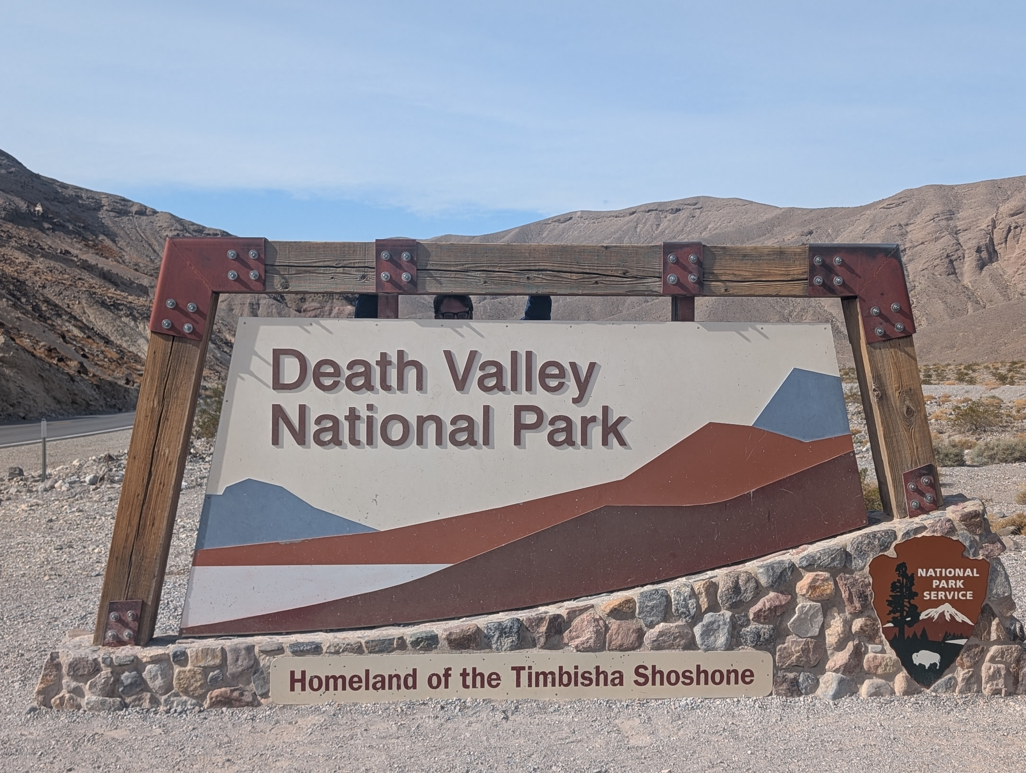
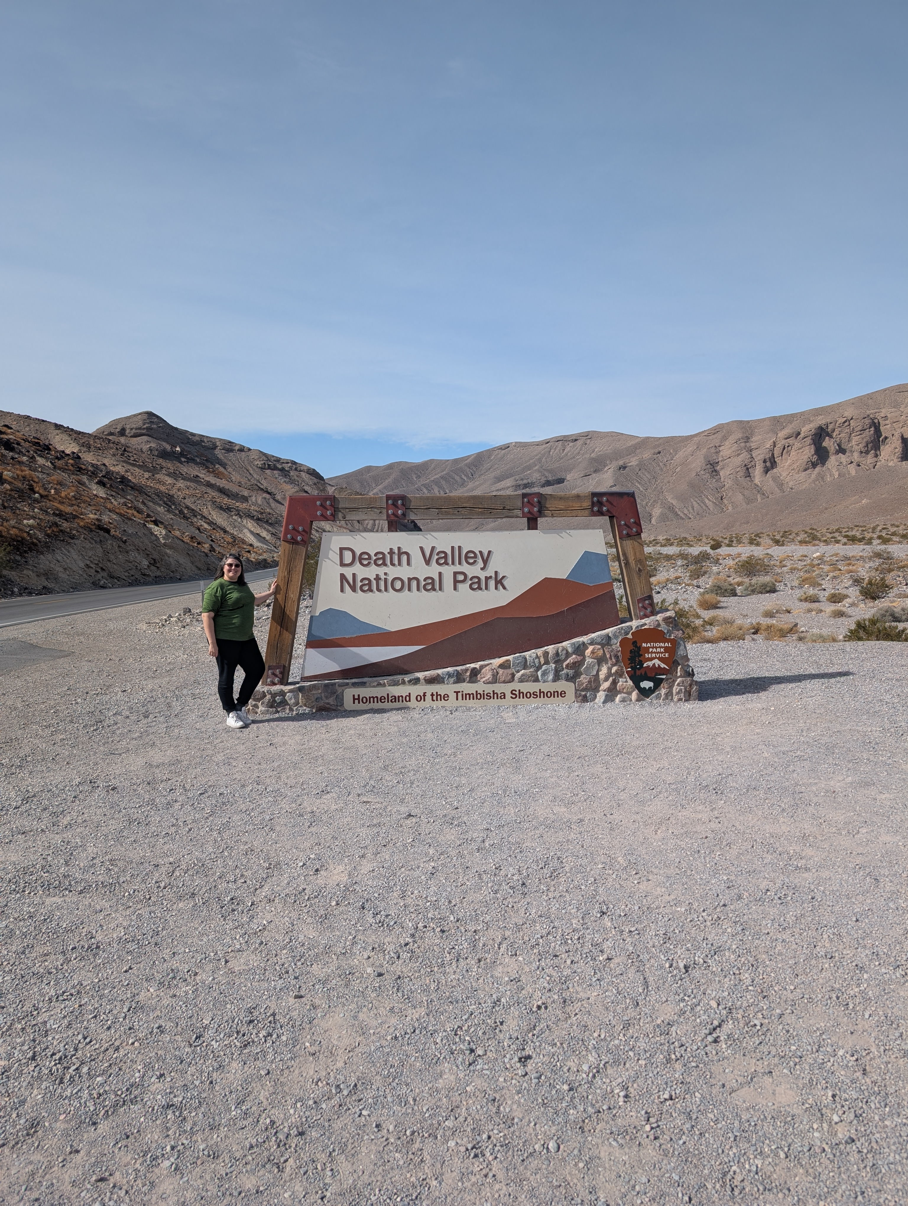
We took a 0700 EST am Saturday flight from Atlanta, GA to Las Vegas, NV and due to the time zone magic landed at about 0900 am PST. We grabbed the bags, picked up the rental car, and headed westward to the town of Pahrump, NV to get some supplies at the last real town before hitting the park. The total drive time from the Airport to Death valley is about 2.5 hours with some traffic time built into the itinerary. That put us at the national park sign at about 1045 PST. I love national park signs and think they give such flavor to the trip. This park sign highlights the Timbisha Shoshone peoples. Now I get it the history between the NPS and indigenous groups is filled with history that we should learn from and not repeat. But this park is an example of where land was returned and recognized as Timbisha Shoshone territory and co-management methods are becoming increasingly accepted between the tribe and the NPS.
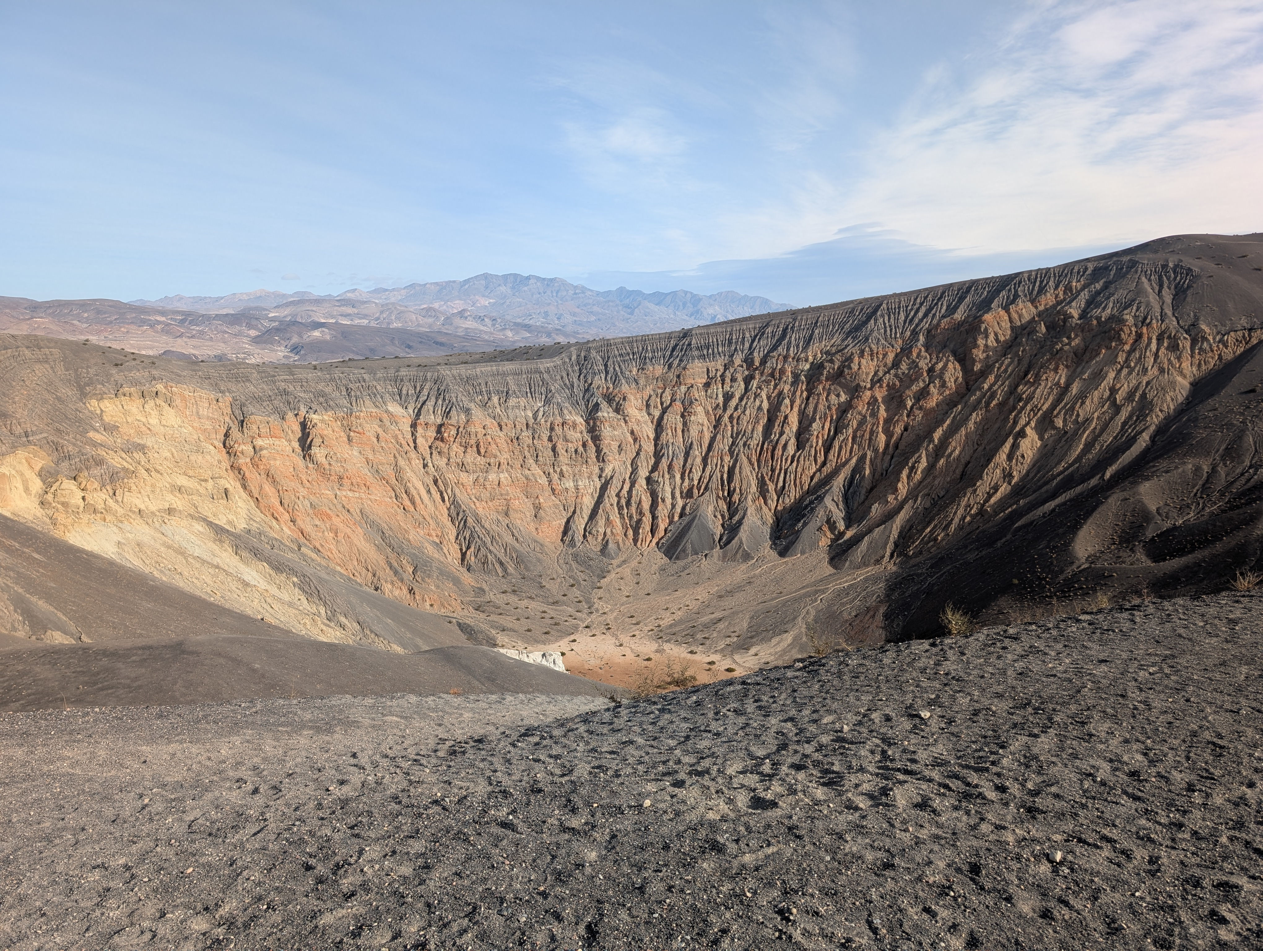
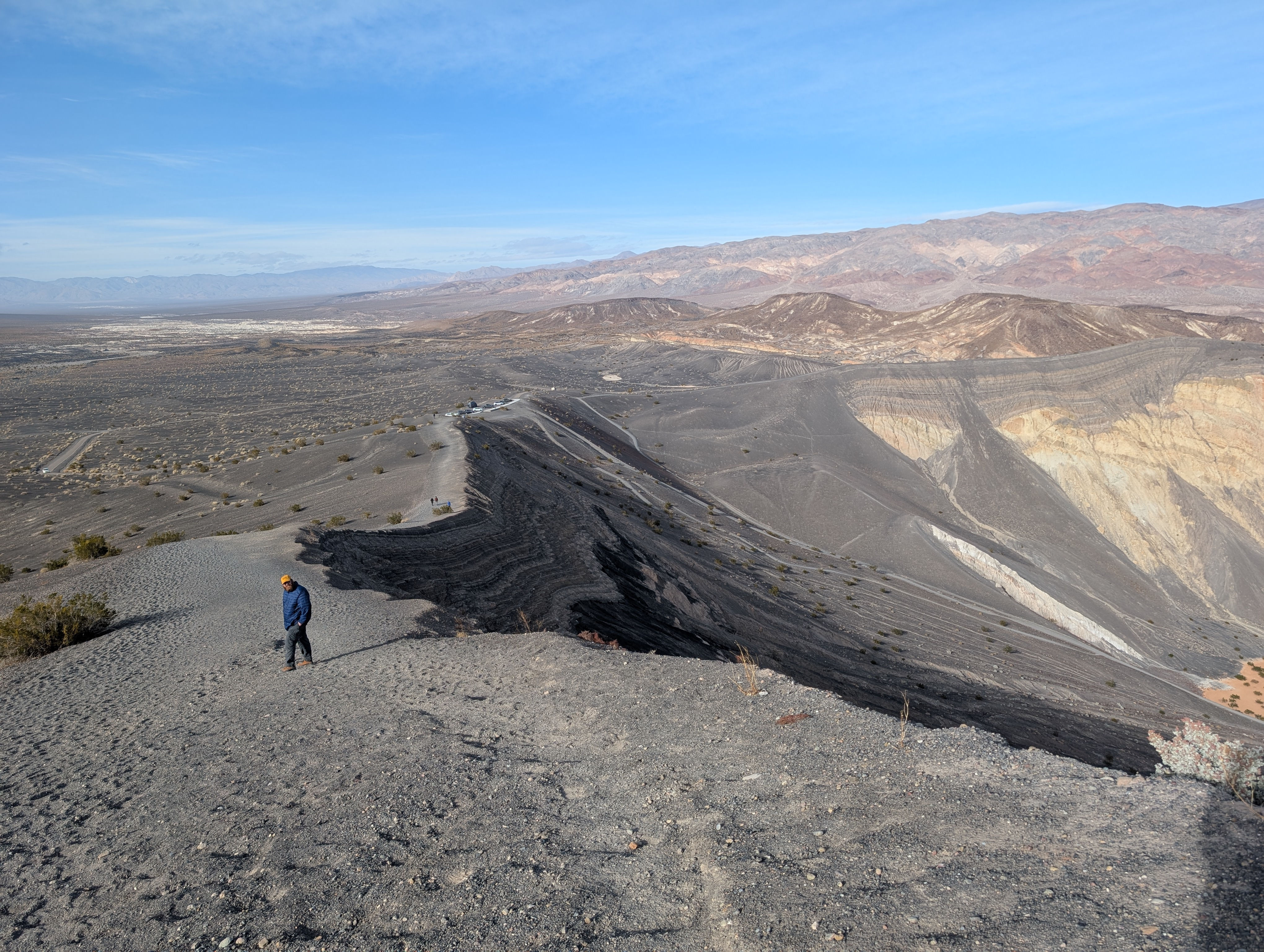
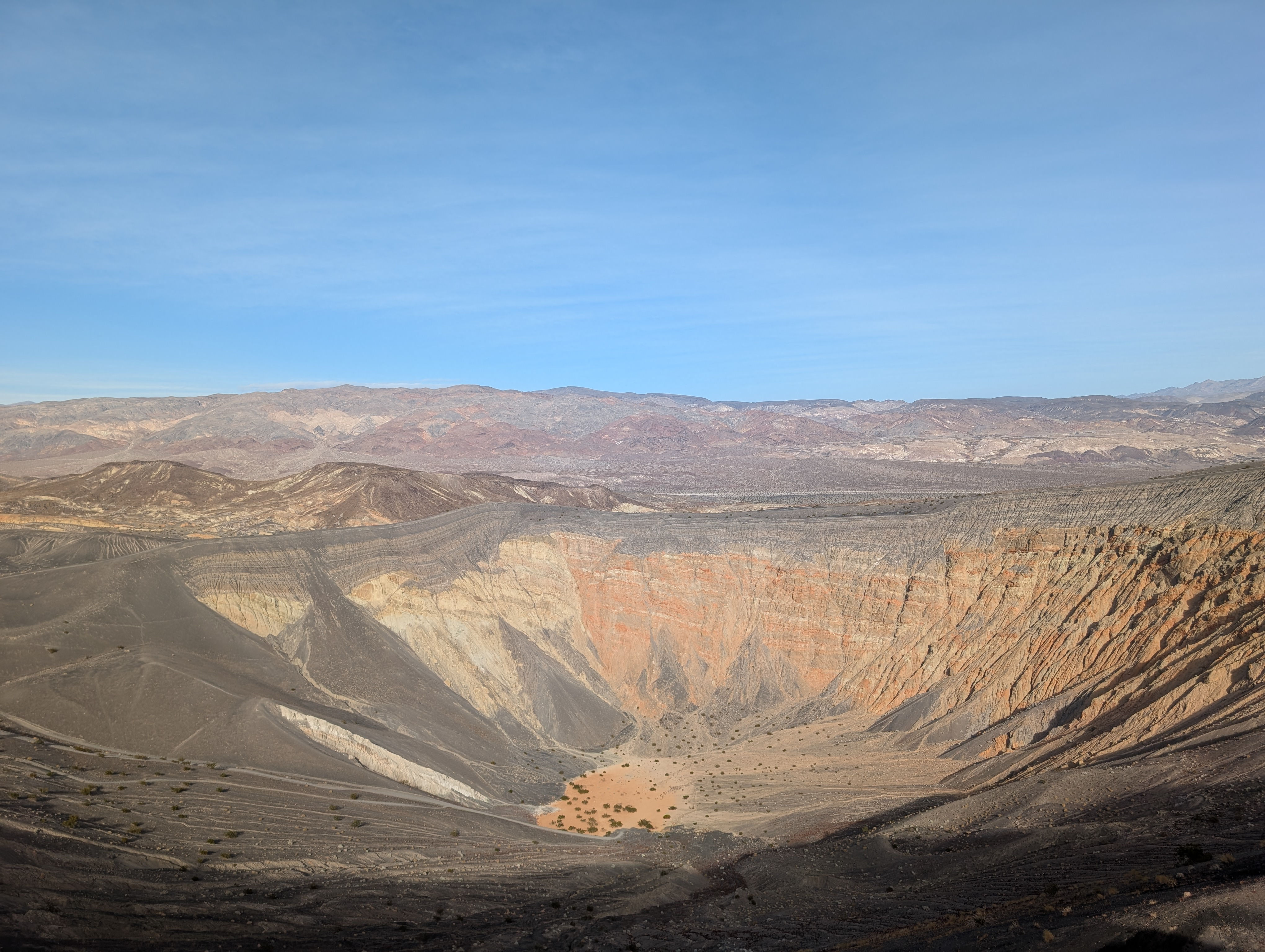
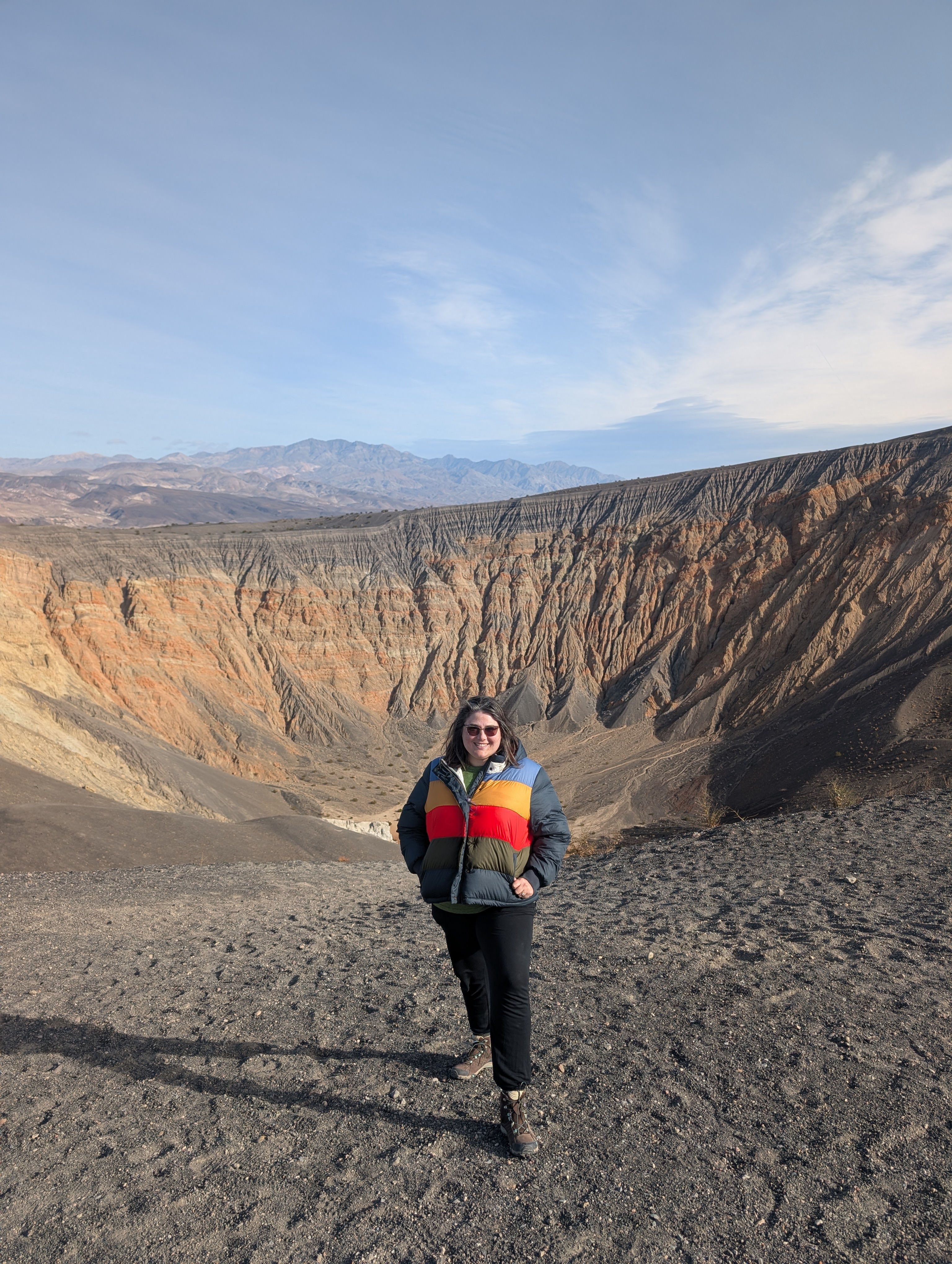
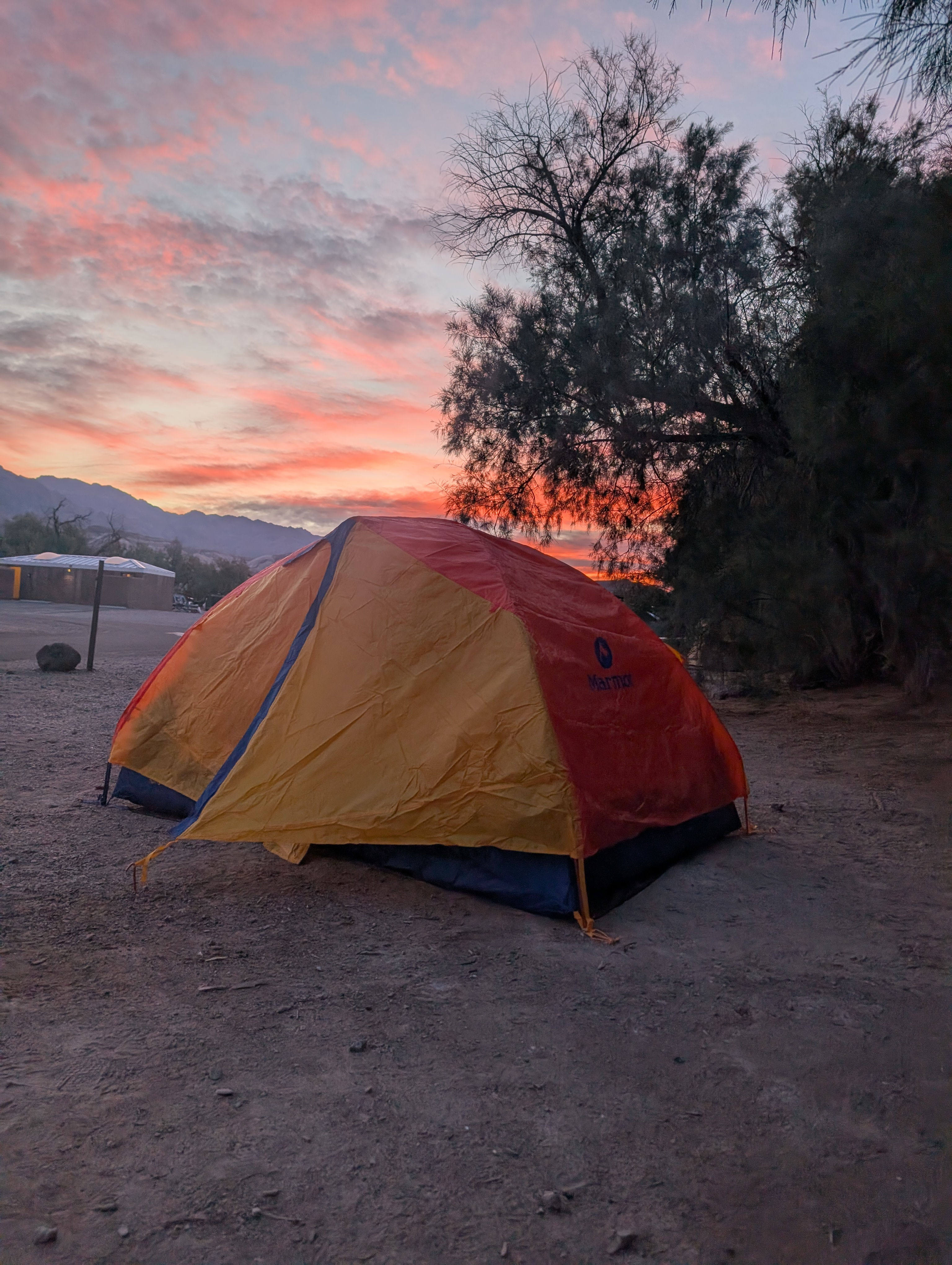
Next stop the Furnace Creek Visitors Center at 1115 PST. The park rangers here were extremely helpful pointing out activates that could fit in our time frame and ranger led activities that were happening while we were in the park. Our campsite at Furnace Creek was ready to check into at 1200 and we set up our home base at spot 105! This campsite definitely felt less private than a lot of NPS sights I have been at but it was also walking distance to the Visitors center and had well kept up flush toilets and potable water. Remember to leave no trace as the crows and coyotes of Death Valley have become far to interested in there human visitors. Per the Rangers suggestions we drove the hour north west to Ubehebe crater. As we drove up the crater surprised us with its size and happily crawled out of our rental car to explore! The park sign let us know that the volcanic crater was 600 feet deep and half a mile across. We decided to hike some of the rim trail. If I were to do it again I would have grabbed our hiking poles out of our luggage because the volcanic cinder material made the climb up pretty slippery but the view was worth it! The crows of Death Valley were living there best life and looked to be floating in place as the winds from the mountains held them high.
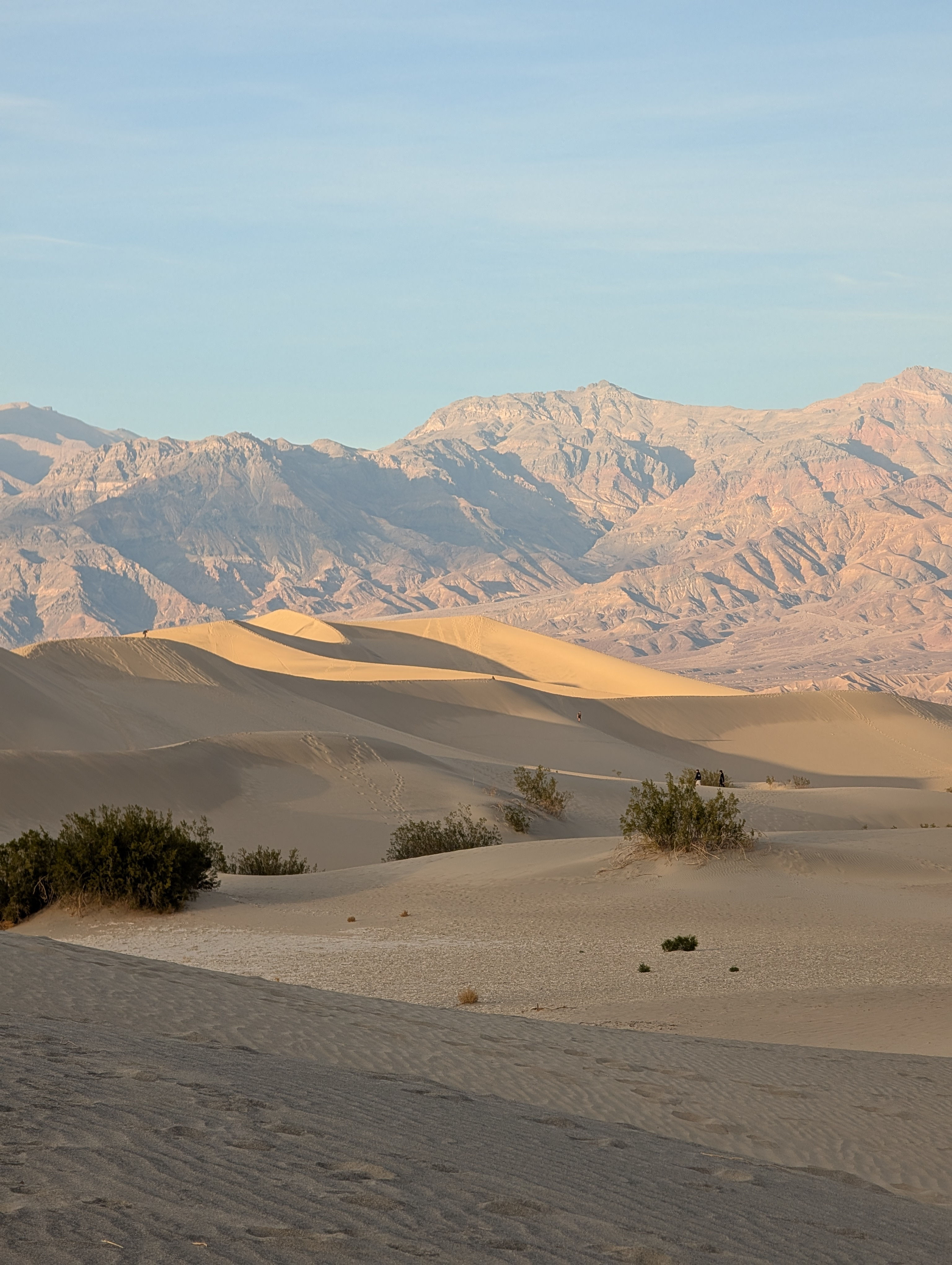
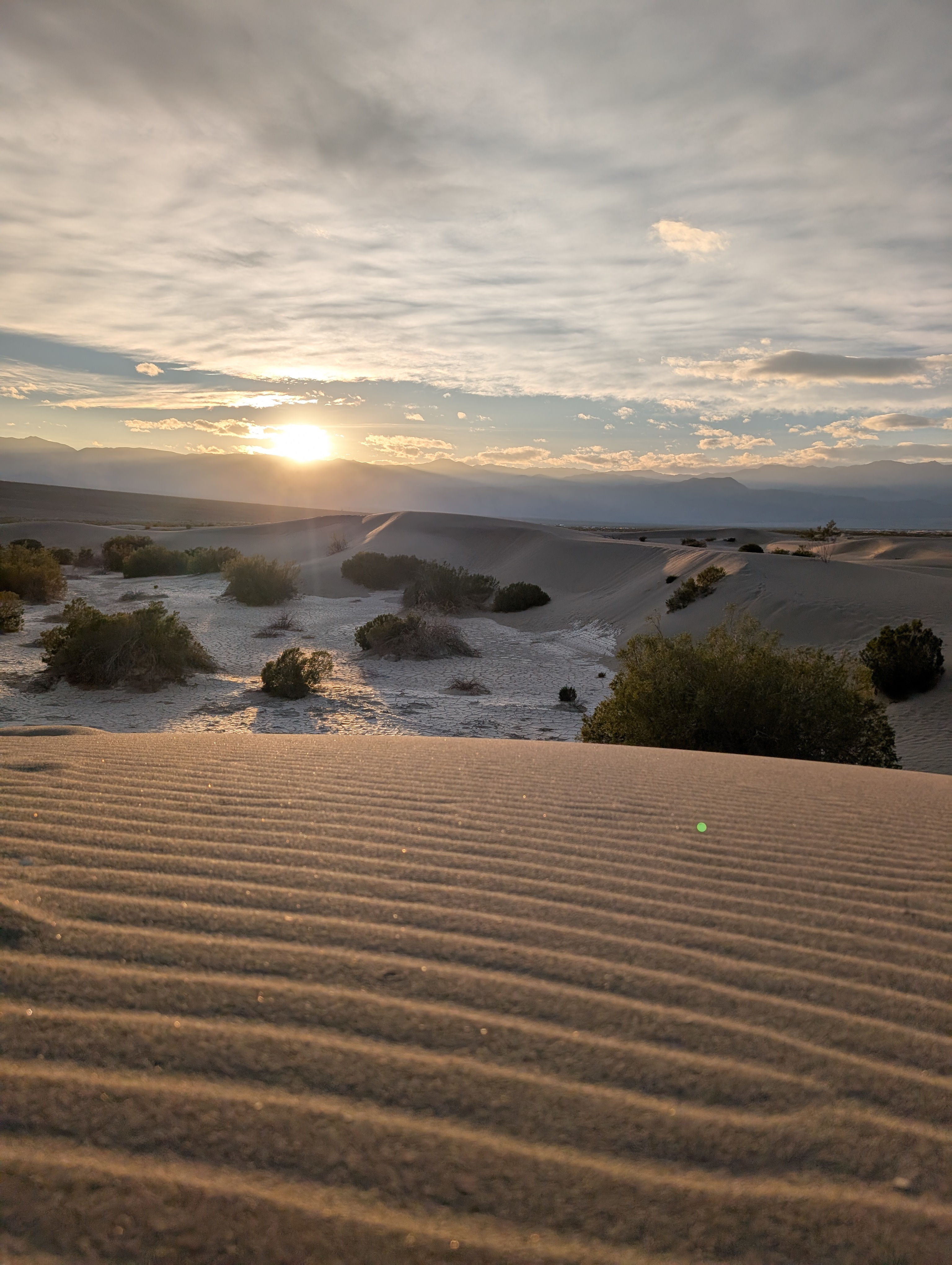
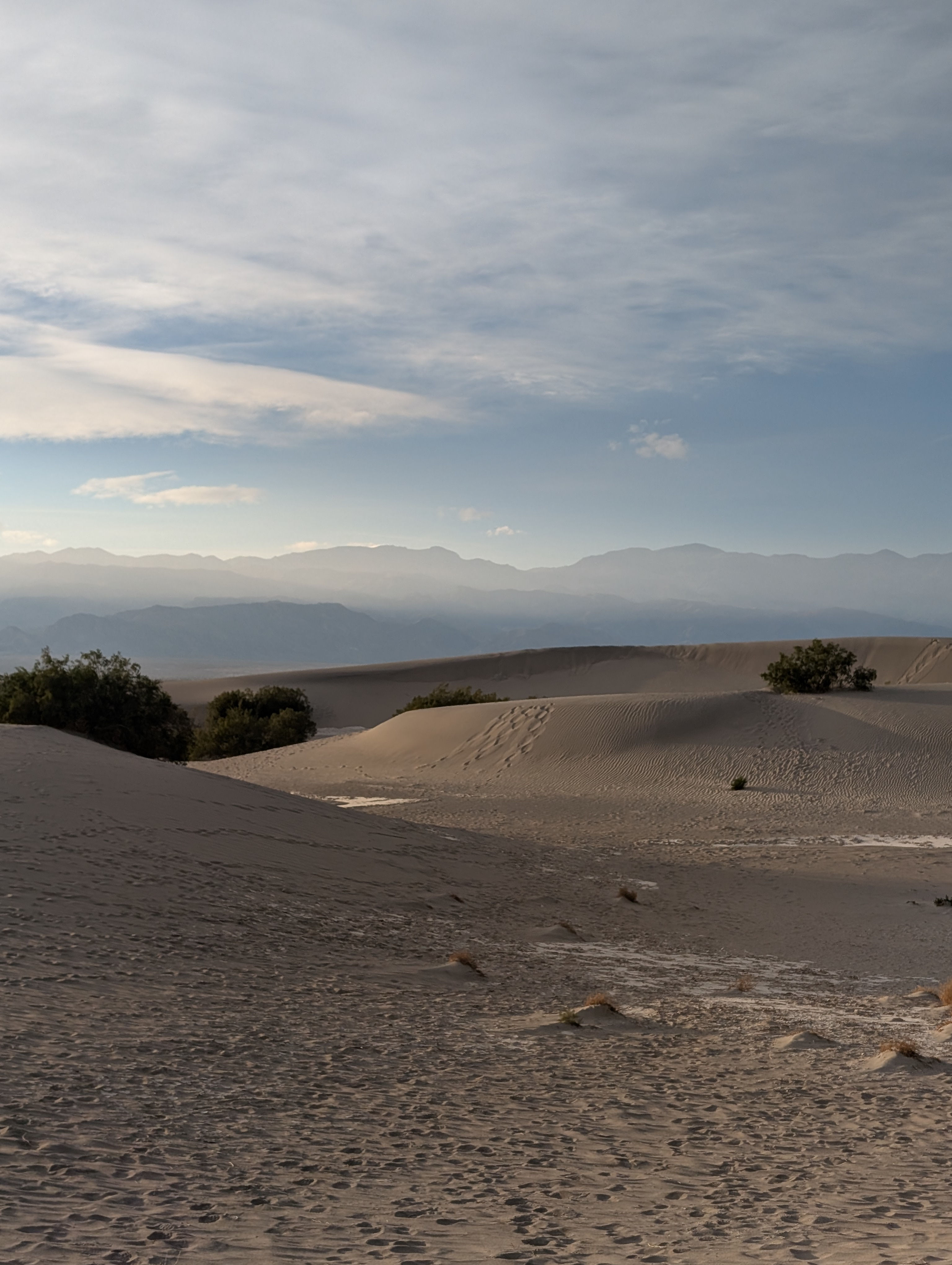
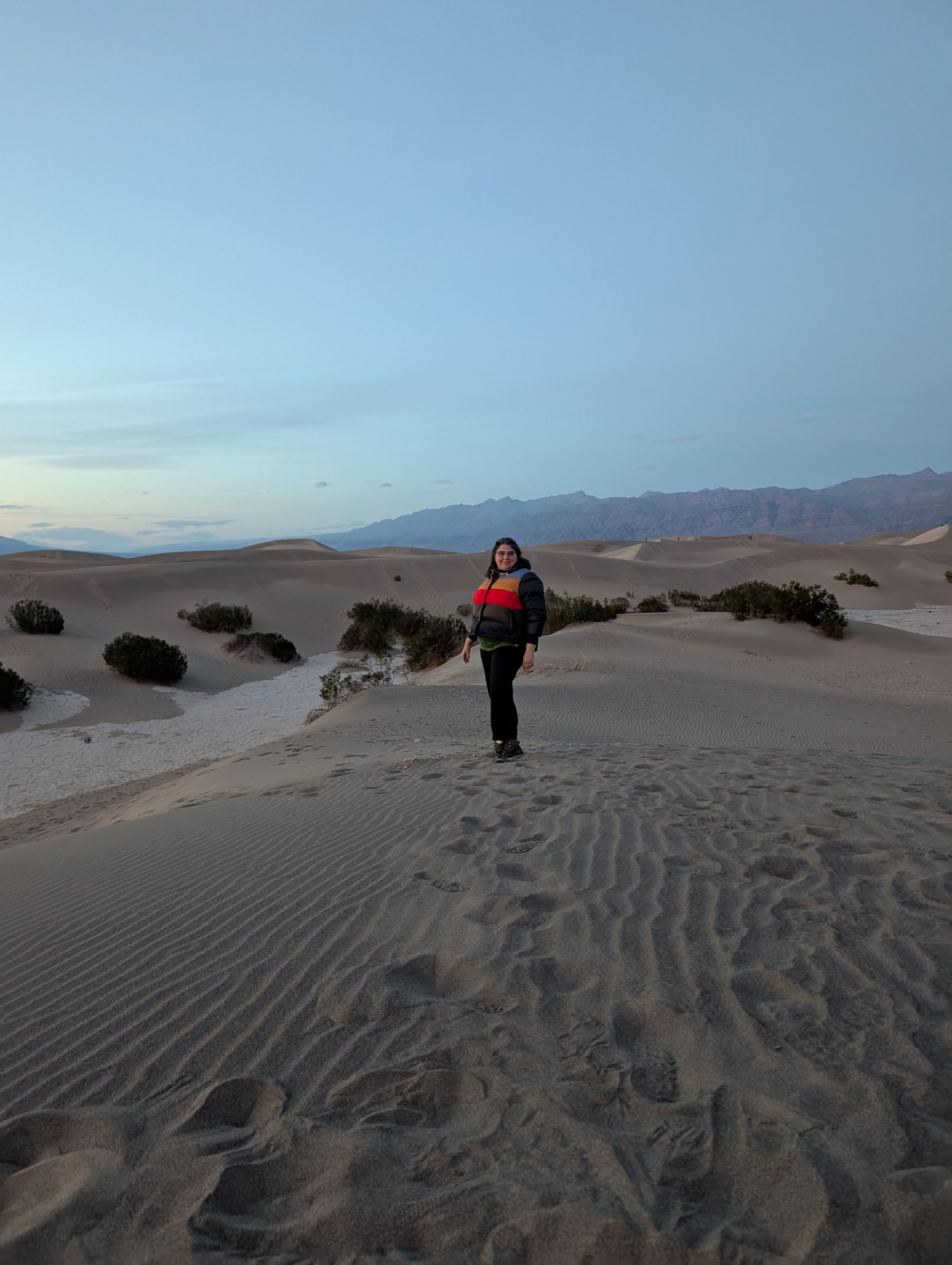
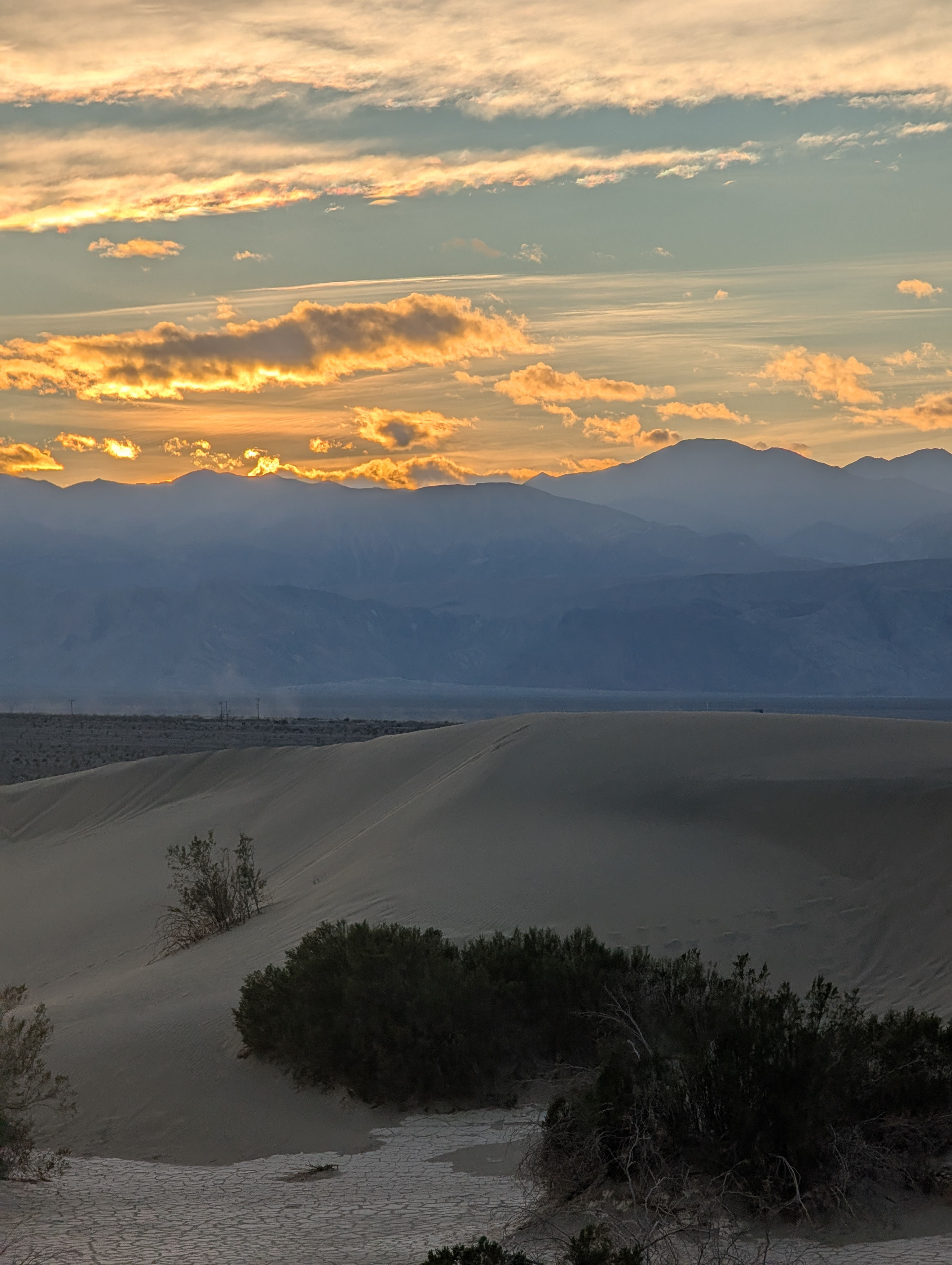
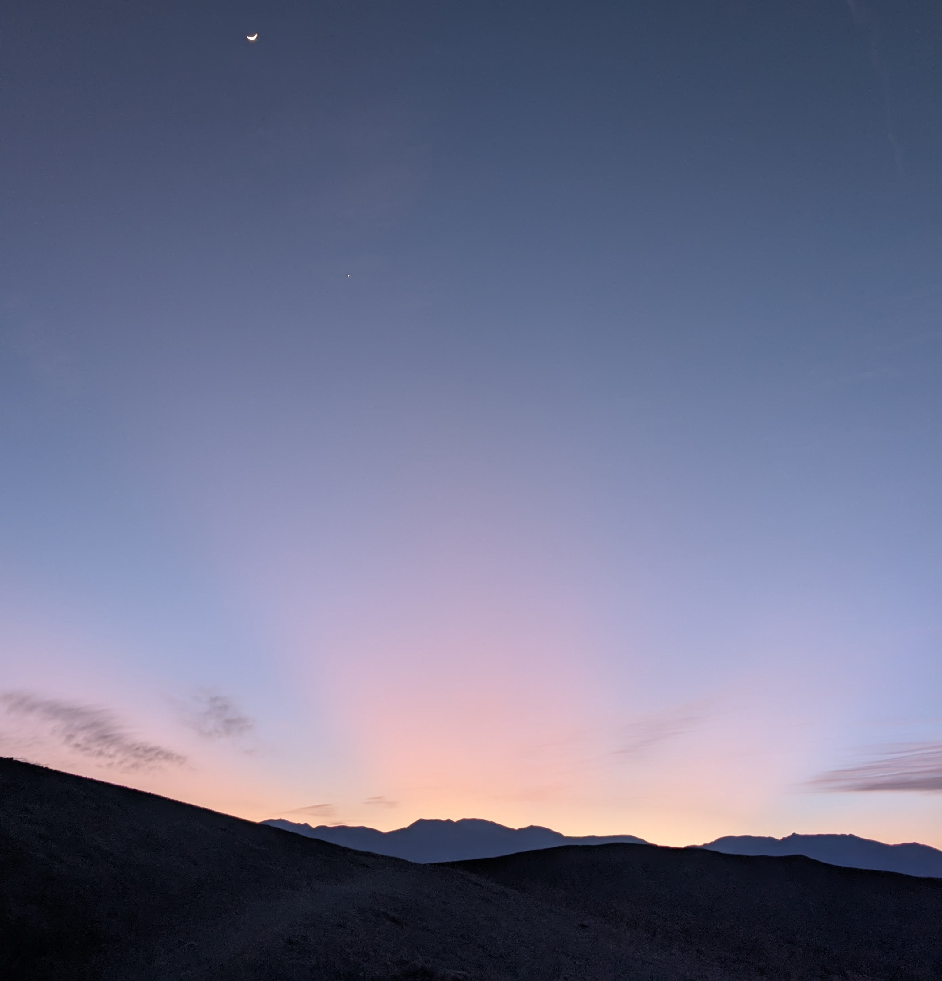
Post walk we drove down to the Mesquite Sand Dunes. And if they look familiar to you Star Wars Fans of the Original trilogy this is one of the many locations in death valley that the movies were filmed in. We grabbed a spot at one of the ranger led hikes that headed out about 1530. From our park ranger we learned that the sand dunes here w ere built due to three factors the source of sand being the eroding mountains to the north, adequate wind to move the sand, and a southern mountain barrier that is preventing the sand from being carried further away; thus causing the due build up. This particular ranger led hike was not my favorite so we dispersed and found a place to have a picnic on the sand dunes and wait for the paintbrushes of sunset to come our way. Seriously remember to pack it in and pack it out if you picnic don't litter! The sunset did not disappoint and we shuffled our way back to the car and camp. Before bed we walked over to the ranger led star gazing event at the visitor center. While the clouds made the stars a bit hard to see; Las Vegas lit up the mountains to the east and showed that even though it is 2.5 hours away the light pollution from the city is still leaking into the park.
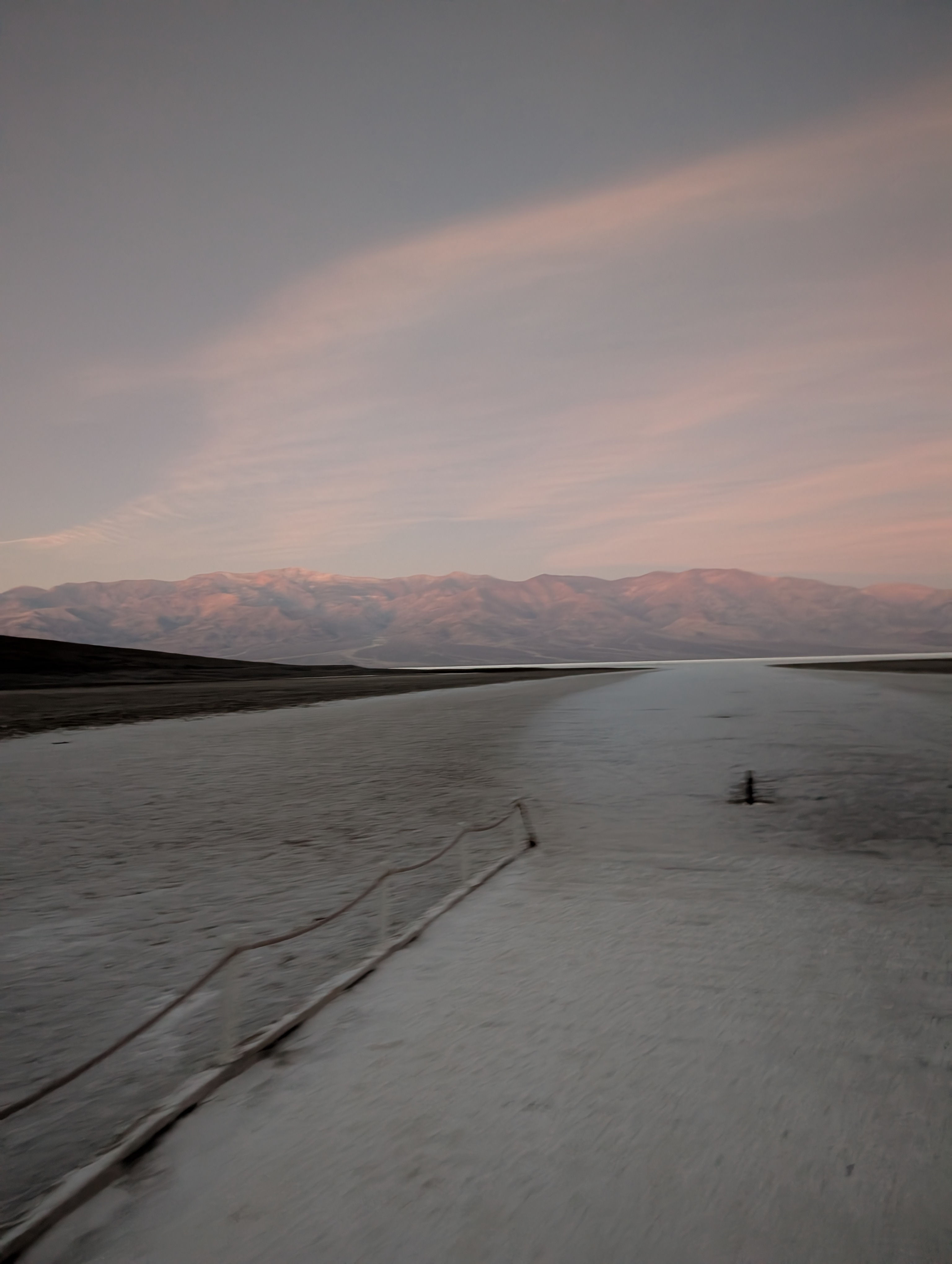
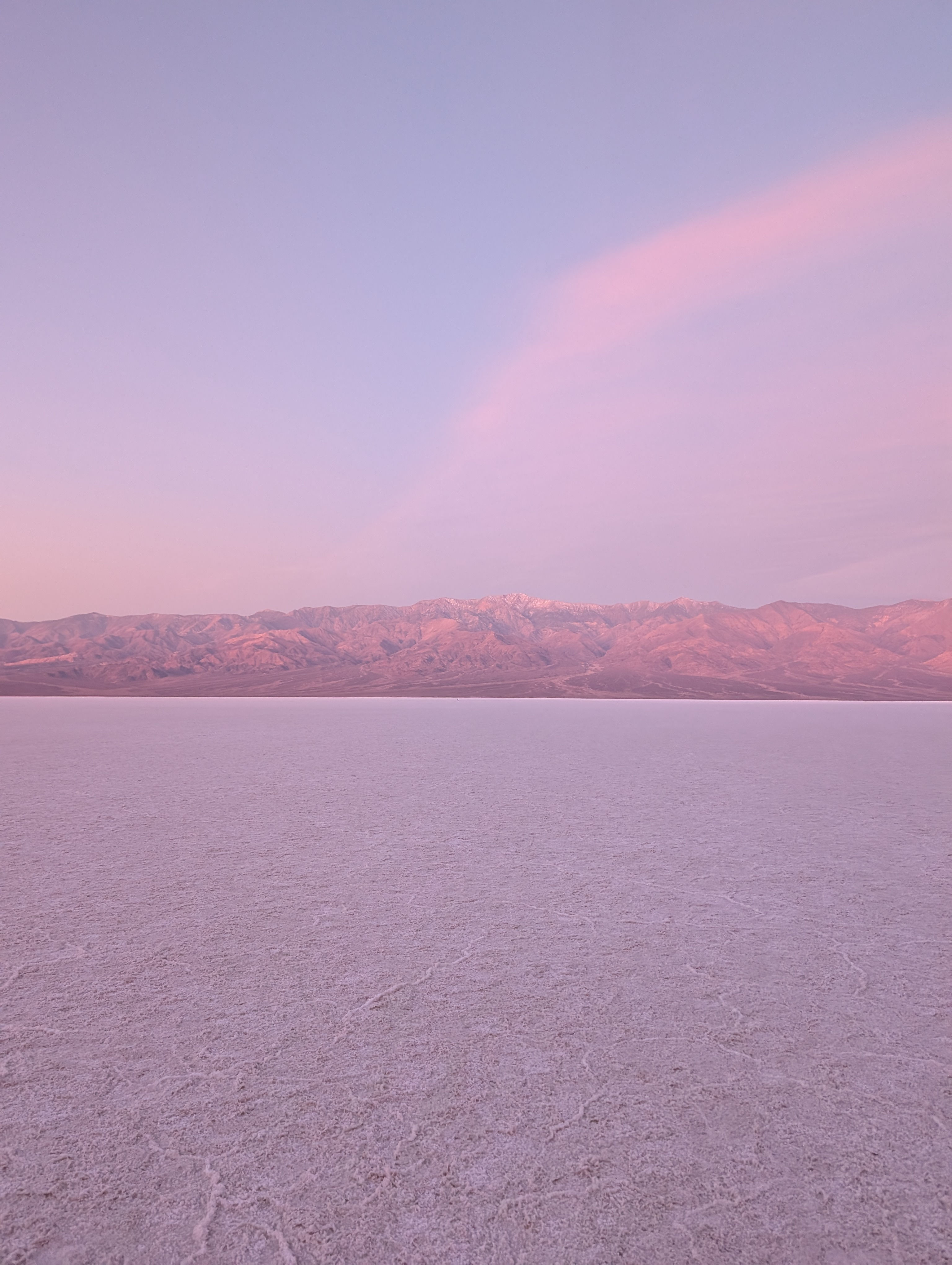
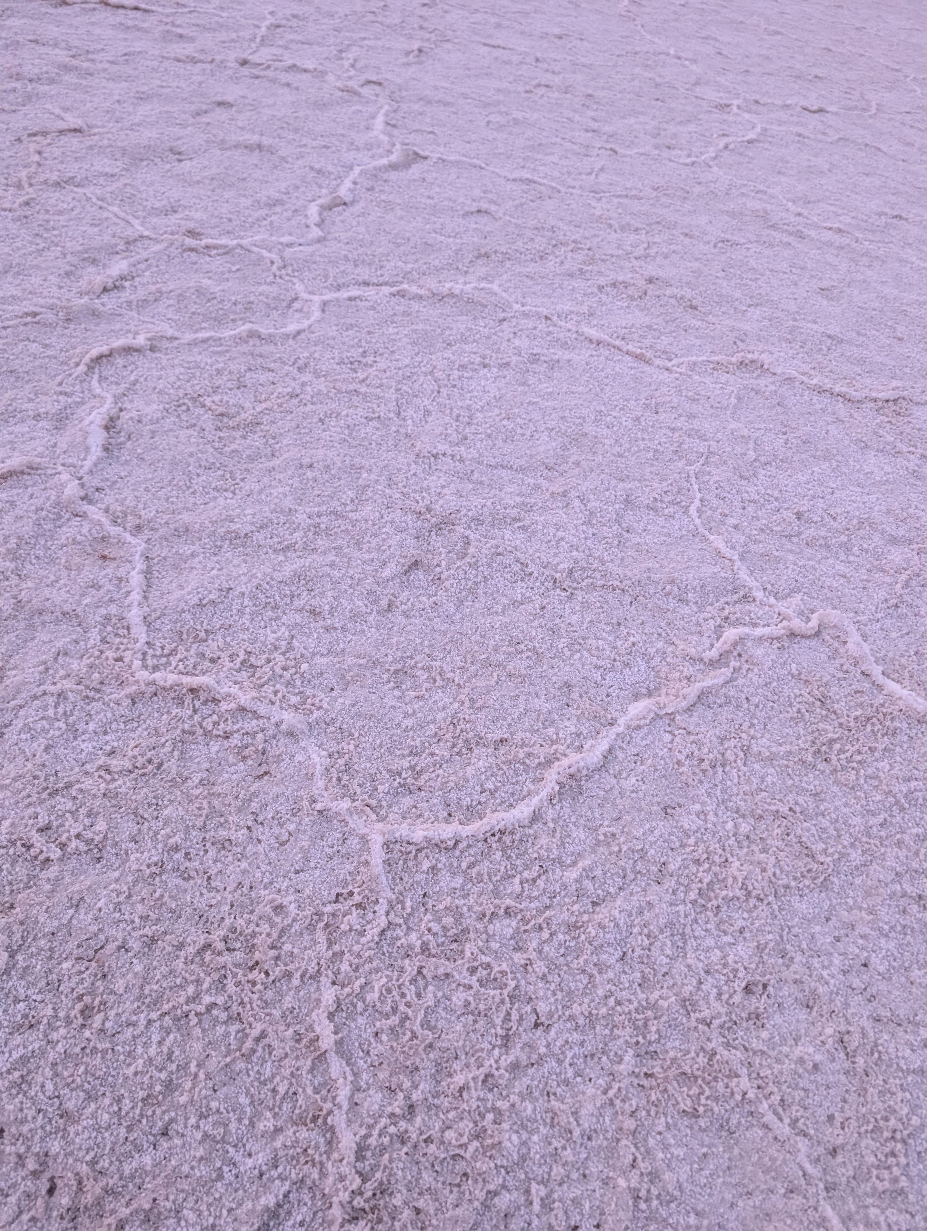
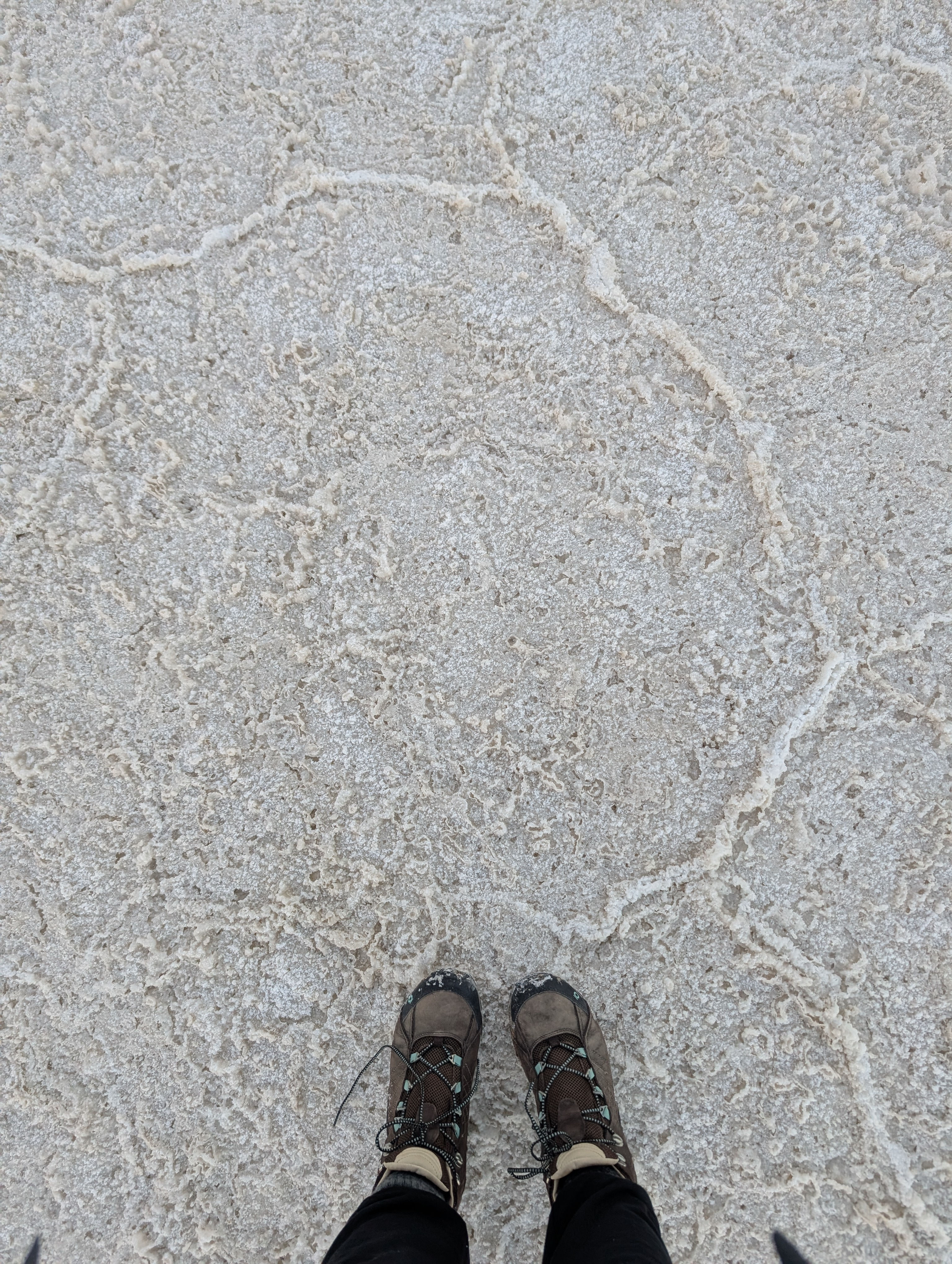
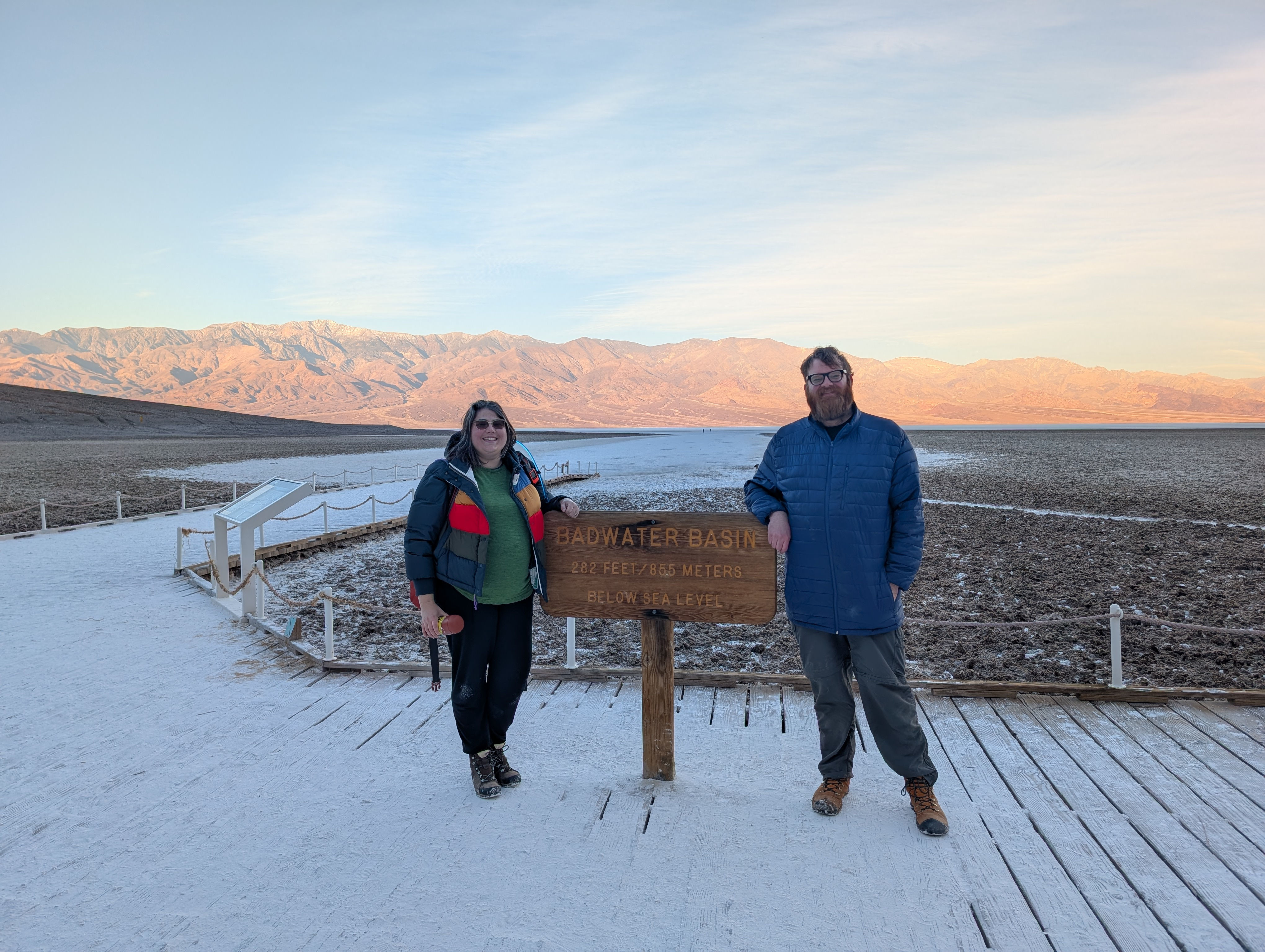
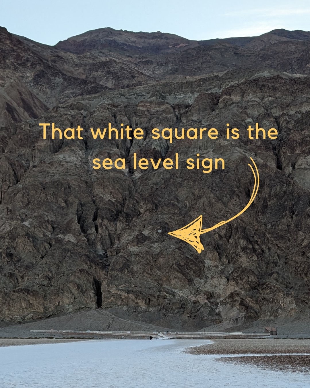
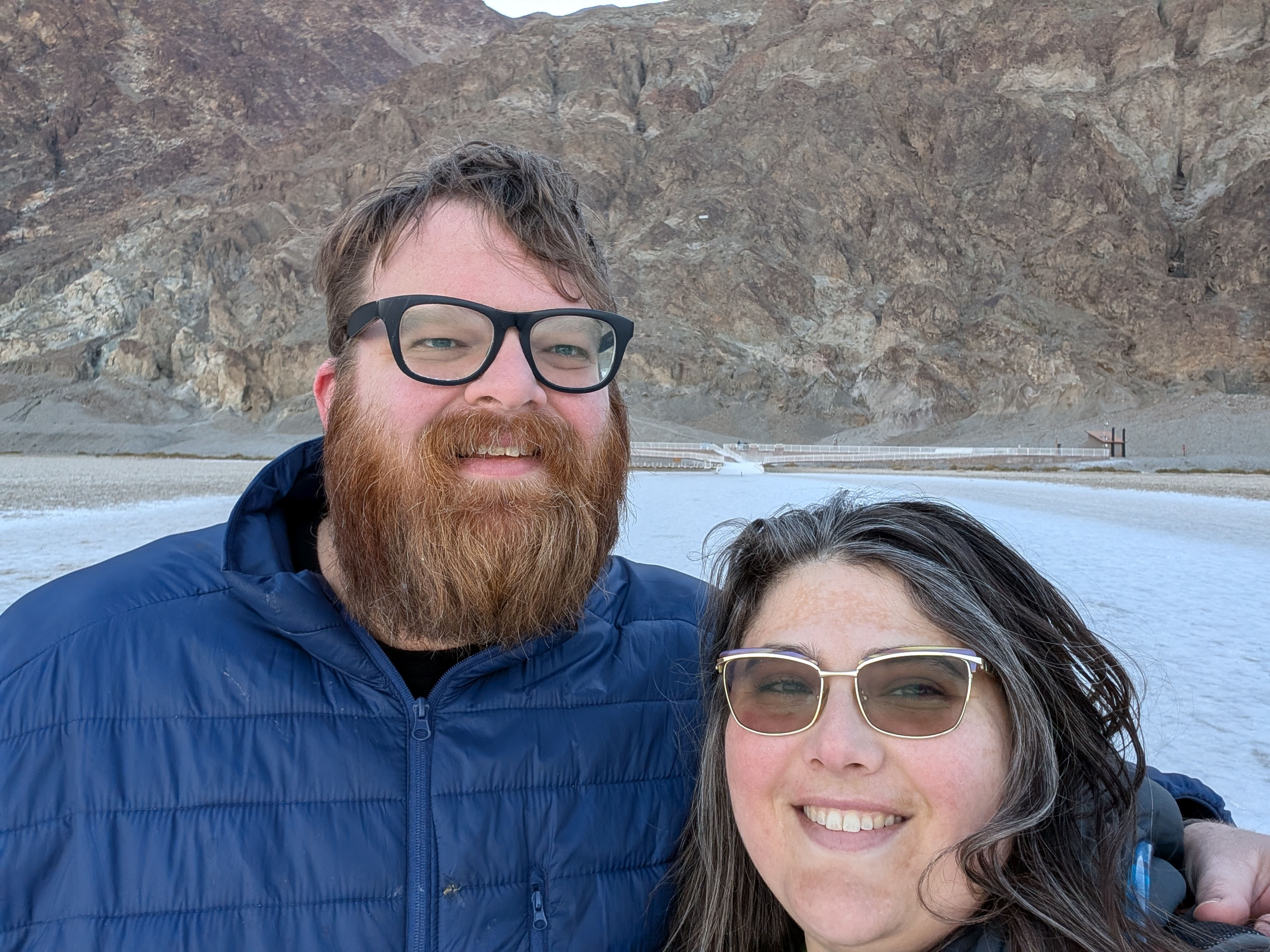
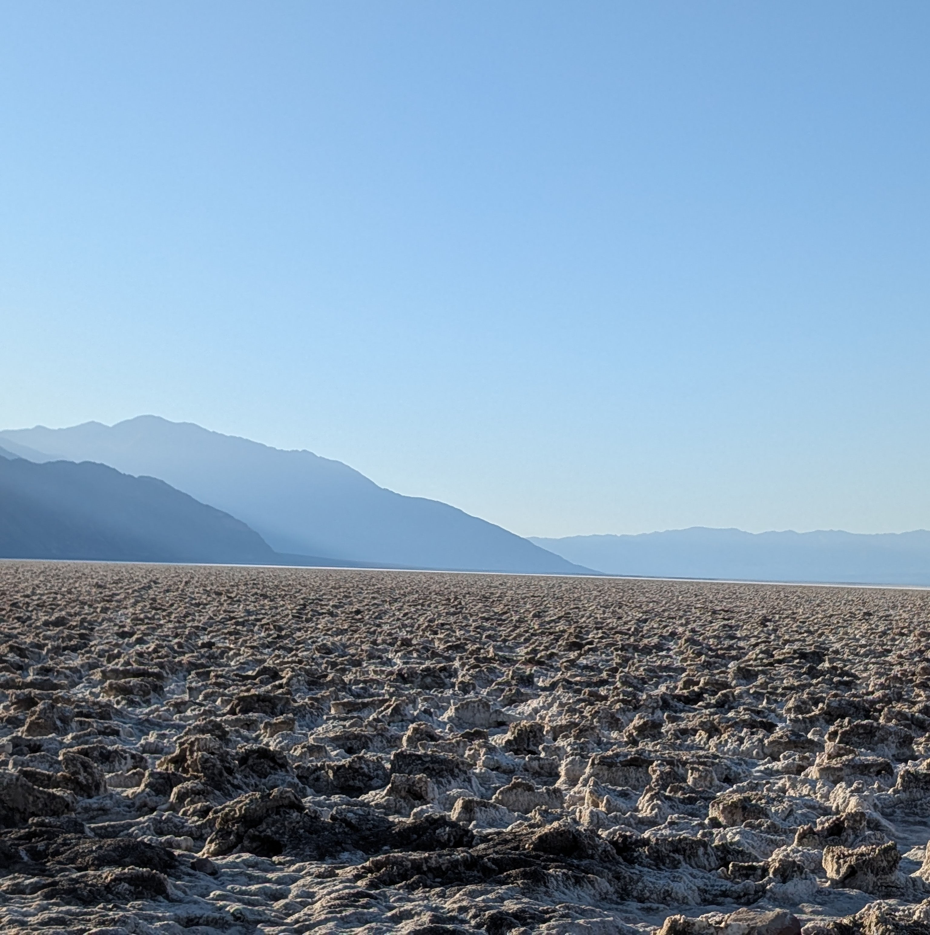
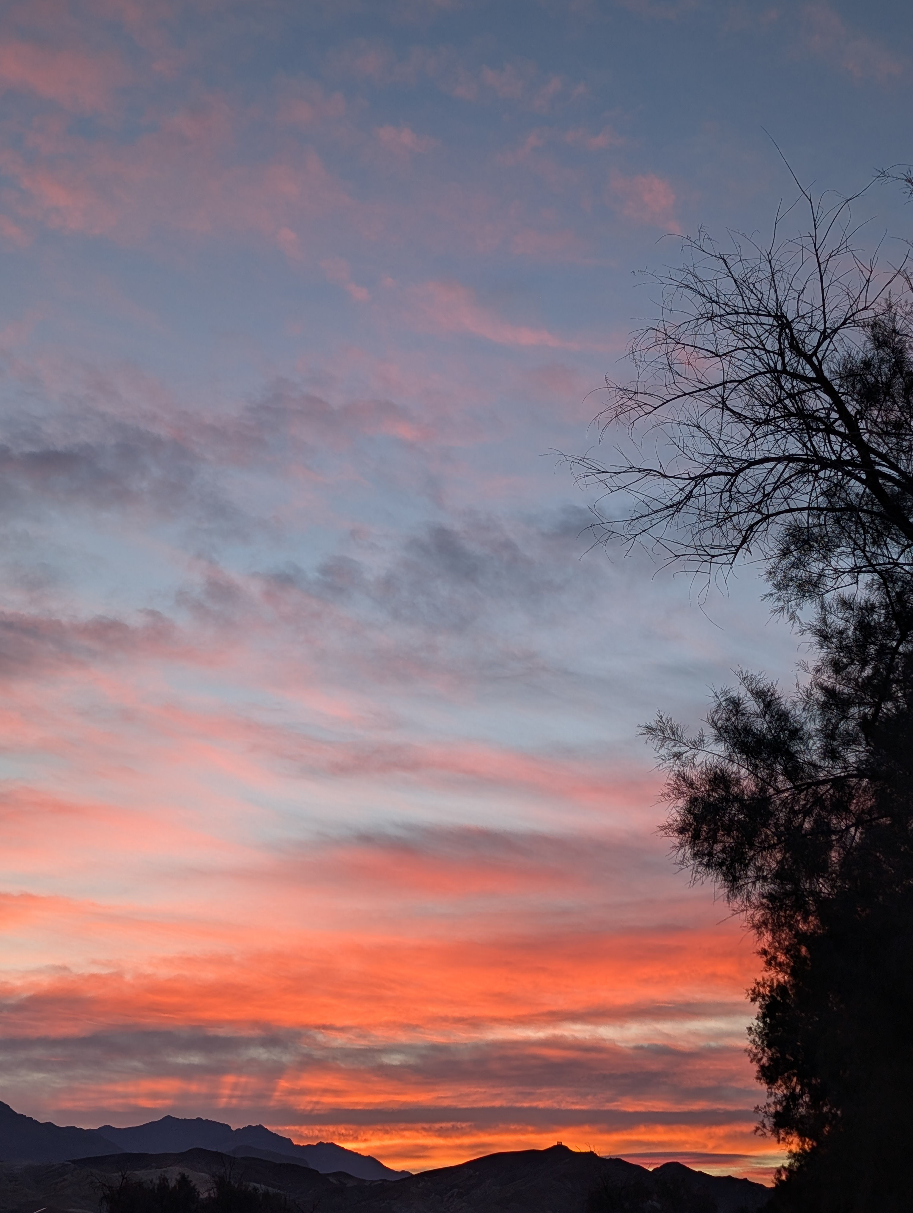
Day 1: The next morning I rolled us out of bed at 0500 and pointed the rental car toward bad water basin. One of my goals was to watch the sunrise from the basin and it did not disappoint. Badwater basin sits at 282 feet below see level with the Panamint Range to the west and the Amargosa Range to the east. When we got to the parking lot there was only one other car and we started the walk from the lot to the salt flats. We had to walk out about a mile to get to a section of salt flats where the hexagon patterns were visible and it was this point were we called it and sat down on the salt flats with our coffee to watch the sun rise. Everything became bathed in shades of pink and hues of purple. As I think back to sitting on the salt and watching the world 350 around me bathed in such tones my minds eye still wonders at how it was real. As the sun continued to rise Telescope peek became more visible and the fresh snow on this highest point in the park showed us its glory. On our walk back we noticed at small white square in the mountain above the car park. It was the sea level sign. Being here at sun rise was epic and I feel more blessed than ever to have gotten to see this side of the world.
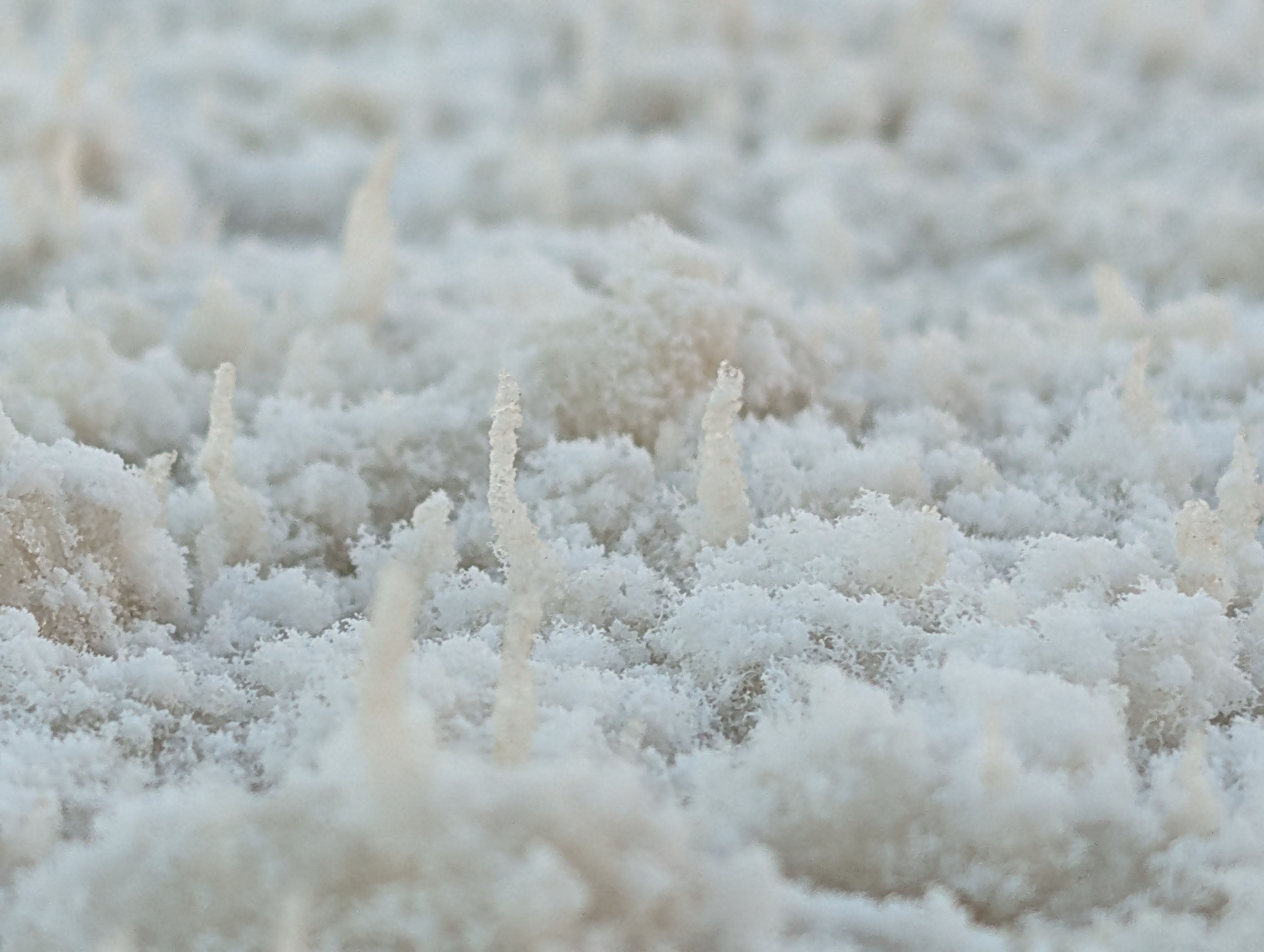
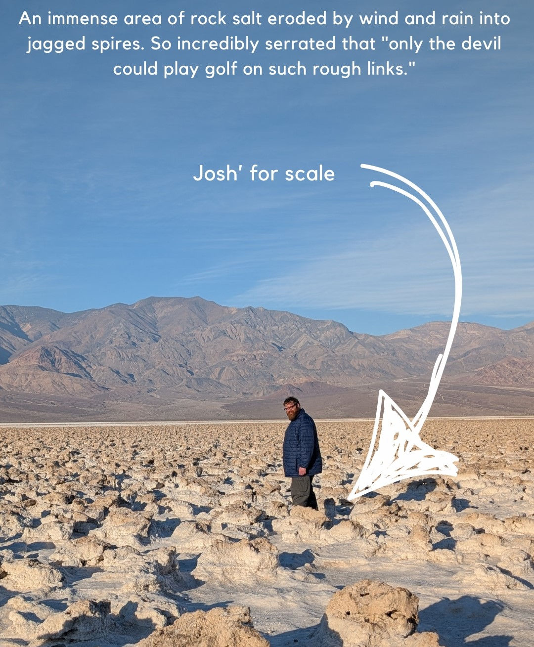
Next we went to visit the devils golf course it is out a dirt road and we nearly missed the turn off. The Devil's Golf Course is a large salt pan on the floor of Death Valley and named because "Only the devil could play golf" on its surface, due to a rough texture from the large halite salt crystal formations. It is one of the landscapes that JPL () tested RoboSimian and after seeing the landscape I understand why they use it as a test bed for ice field maneuverability.
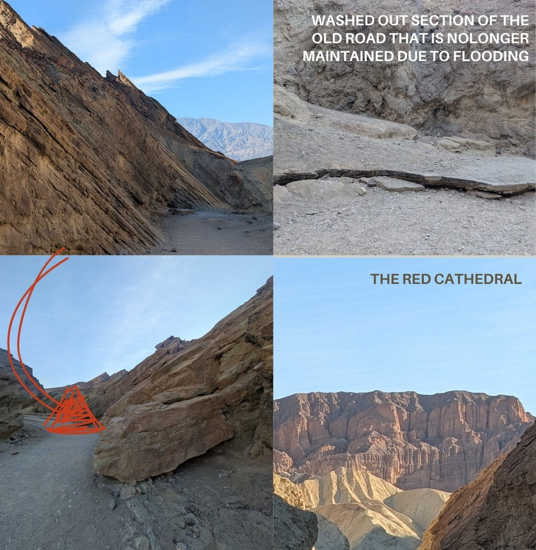
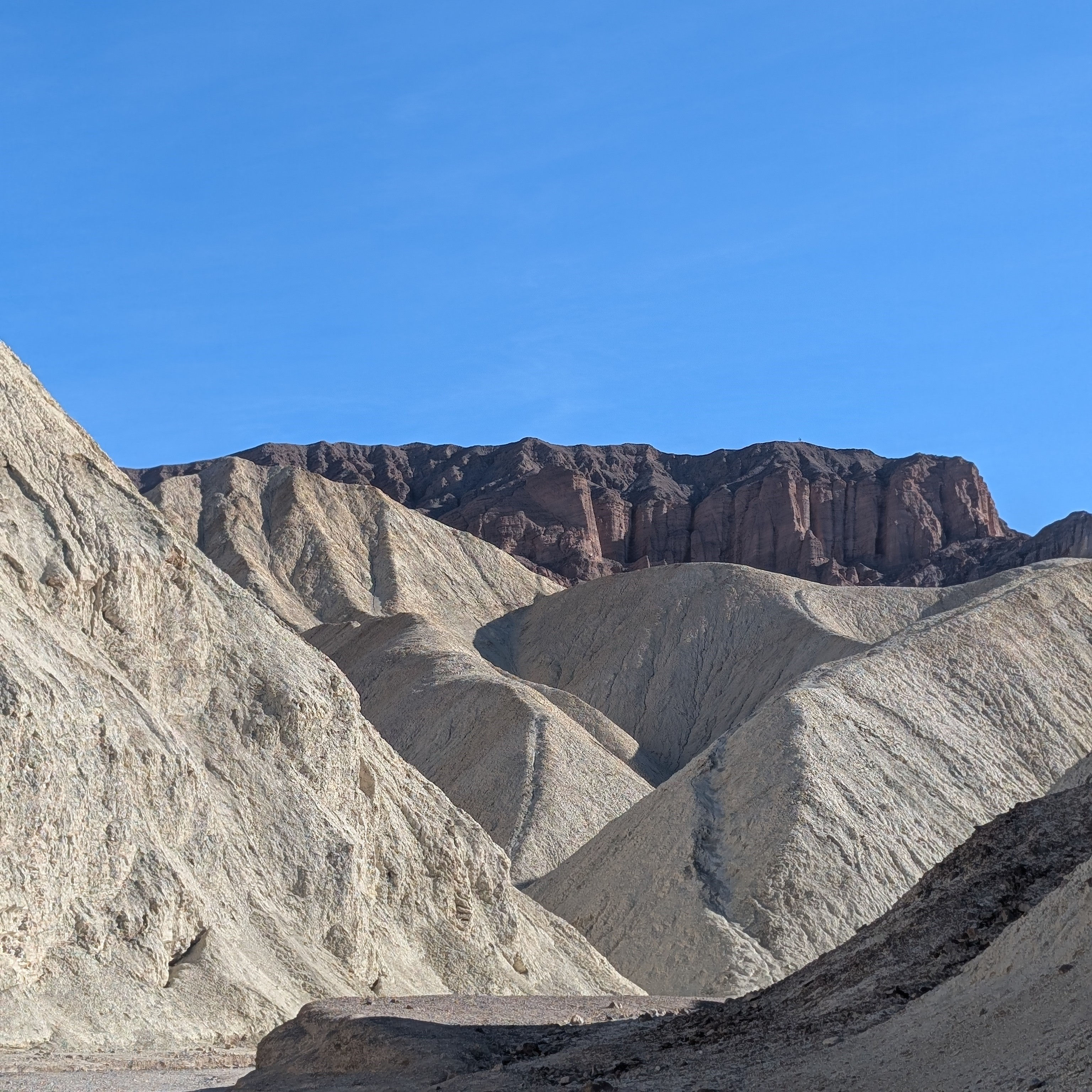
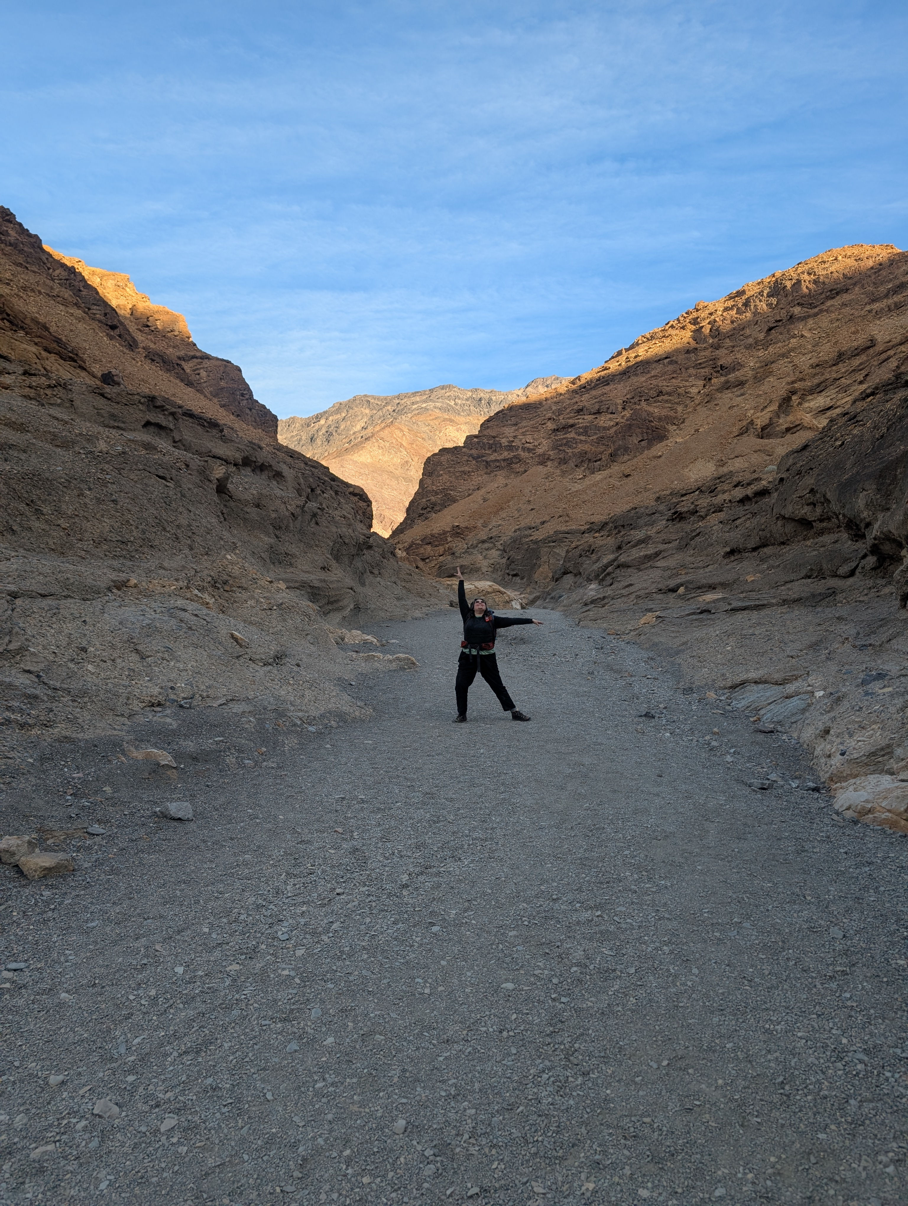
The Next Stop was Golden Canyon, a must for those who have watched star wars as this is the canyon that the Jawas hid and attacked R2D2. The Jawas as it turns out were Death Valley school children who got the day off to dress up and support the film. This ranger let hike was fire as we learned that it only takes 0.15 Inches of rain across death valley to fill this canyon with a foot of floodwater; you can even see part of an old road that is no longer maintained that has been washed away by the normal water events. We hiked up and got to see the red cathedral, learn about the types of rock in the valley and the different fault types in the earth.
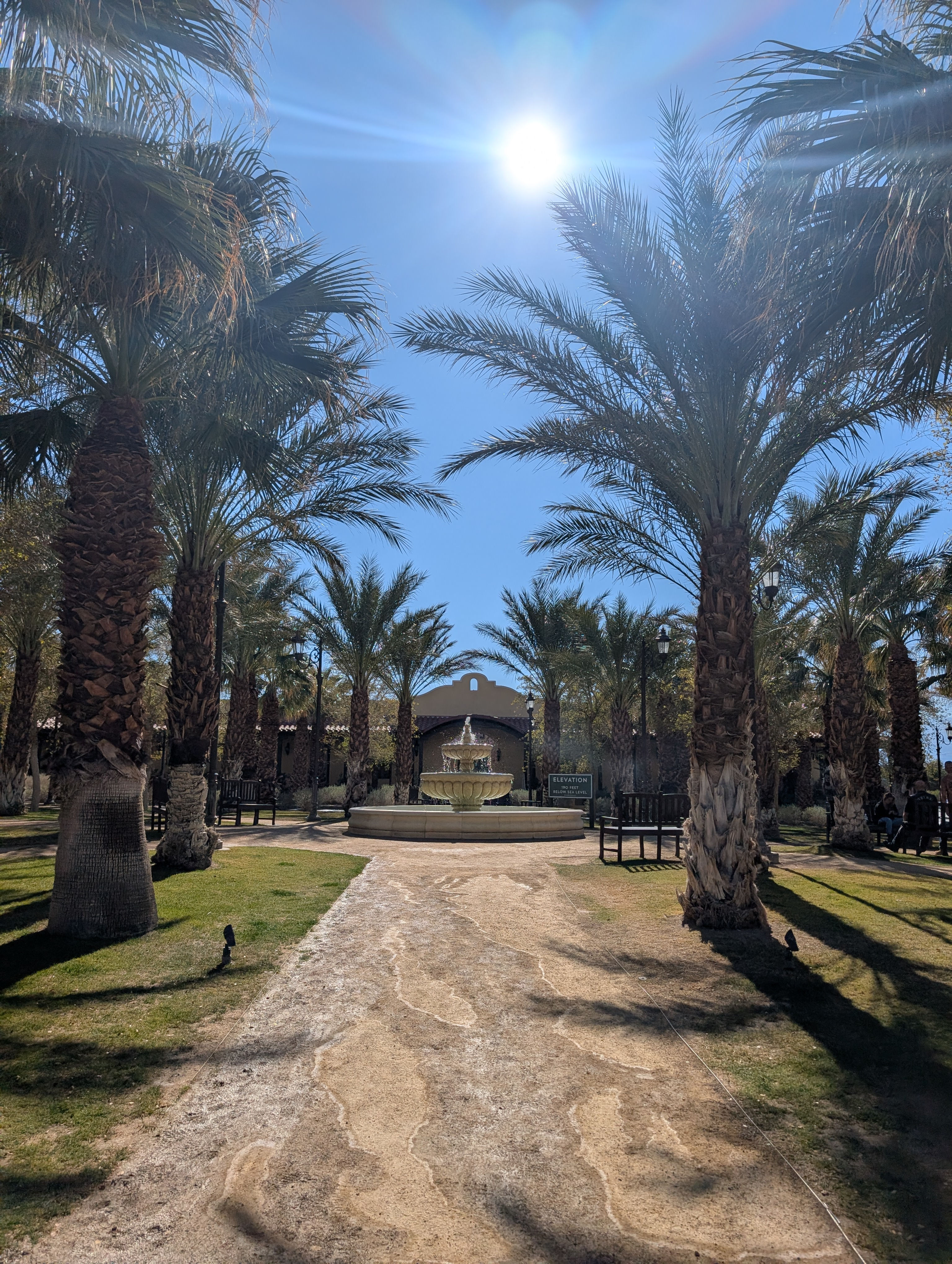
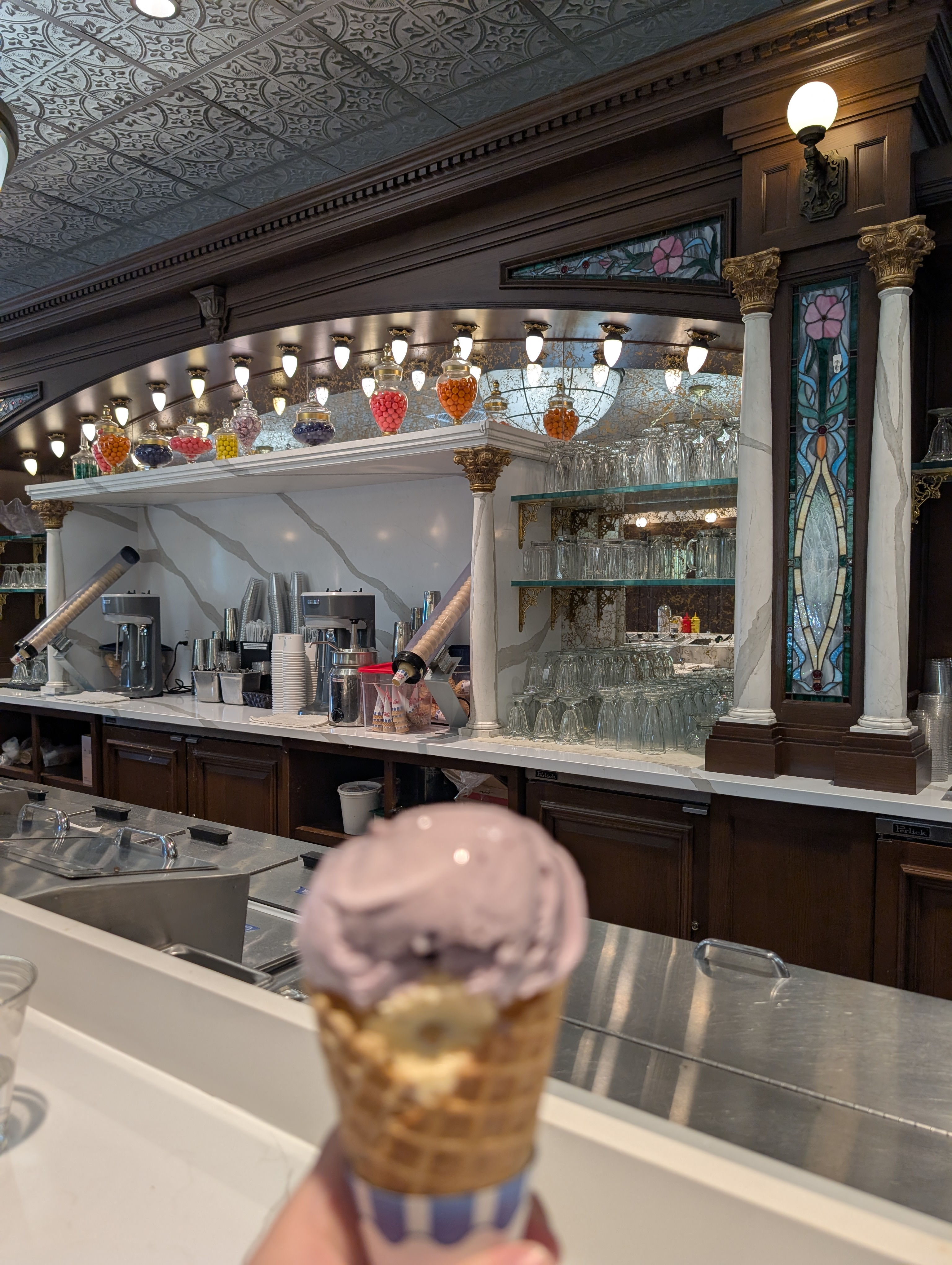
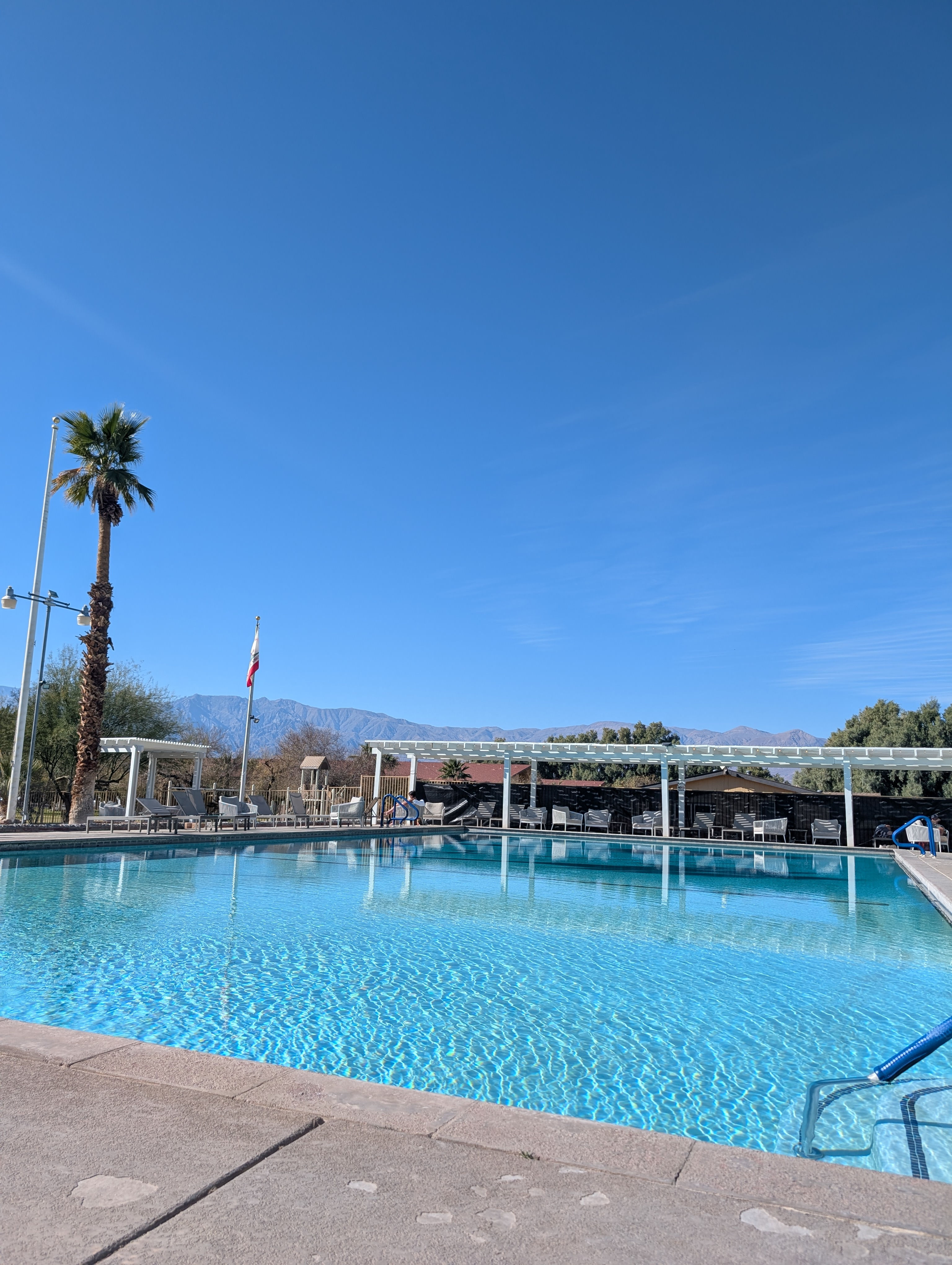
Post hike we went to find a shower. There are no NPS showers in death valley but The Ranch at Death Valley has pool pass/shower passes that you can purchase. The shower facilities and pool facilities at The Ranch definitely showed there age but it felt great to get a layer of the dust we had accumulated off. We sat in the sun on the pool deck and then went over to the Ice Cream Parlor for desert first and then lunch. The Ranch was odd with all of its fountains, sprinklers, golf course, and palm trees it definitely felt out of place against the scenery. Post all of our food we headed back to camp for a mid day post lunch nap!
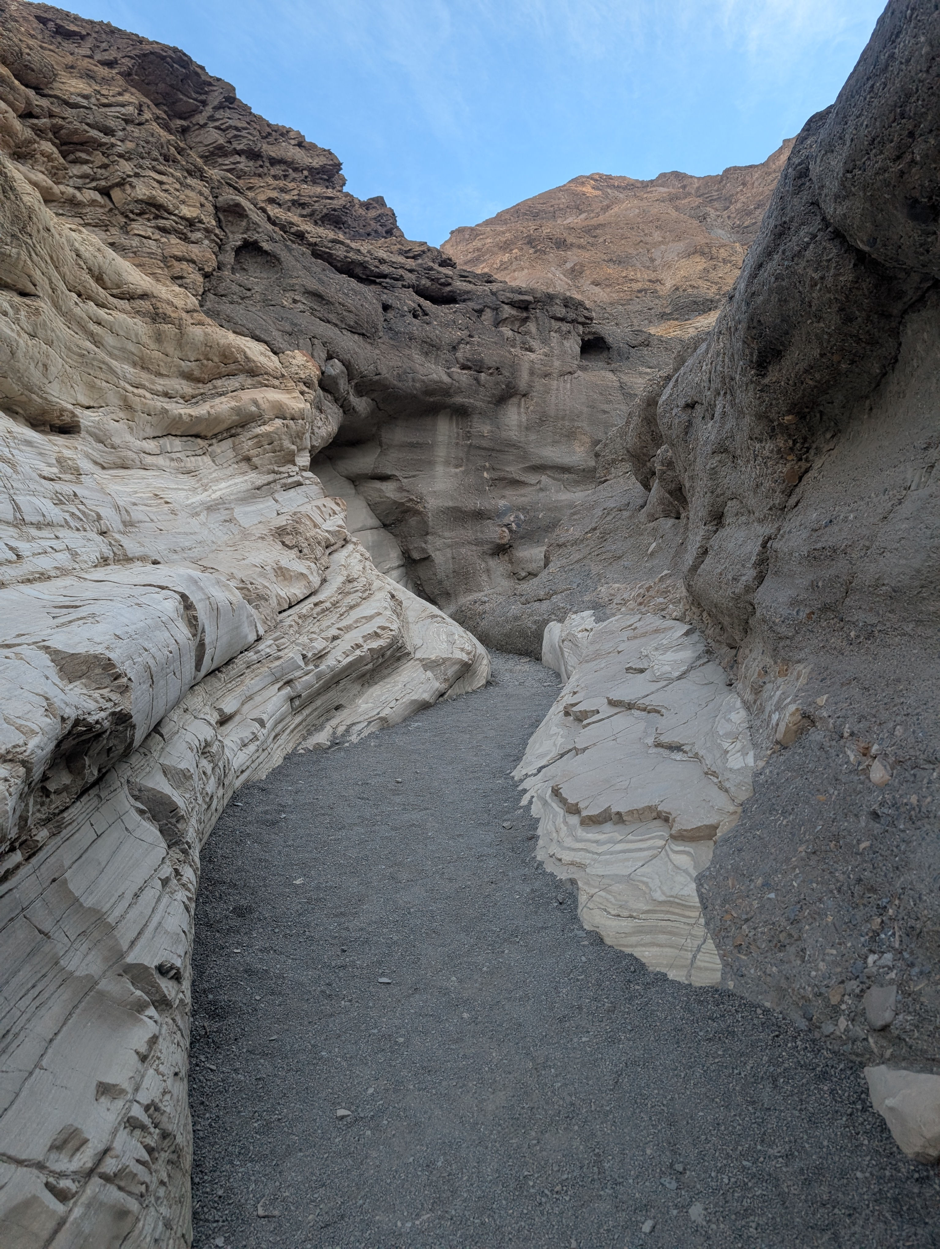
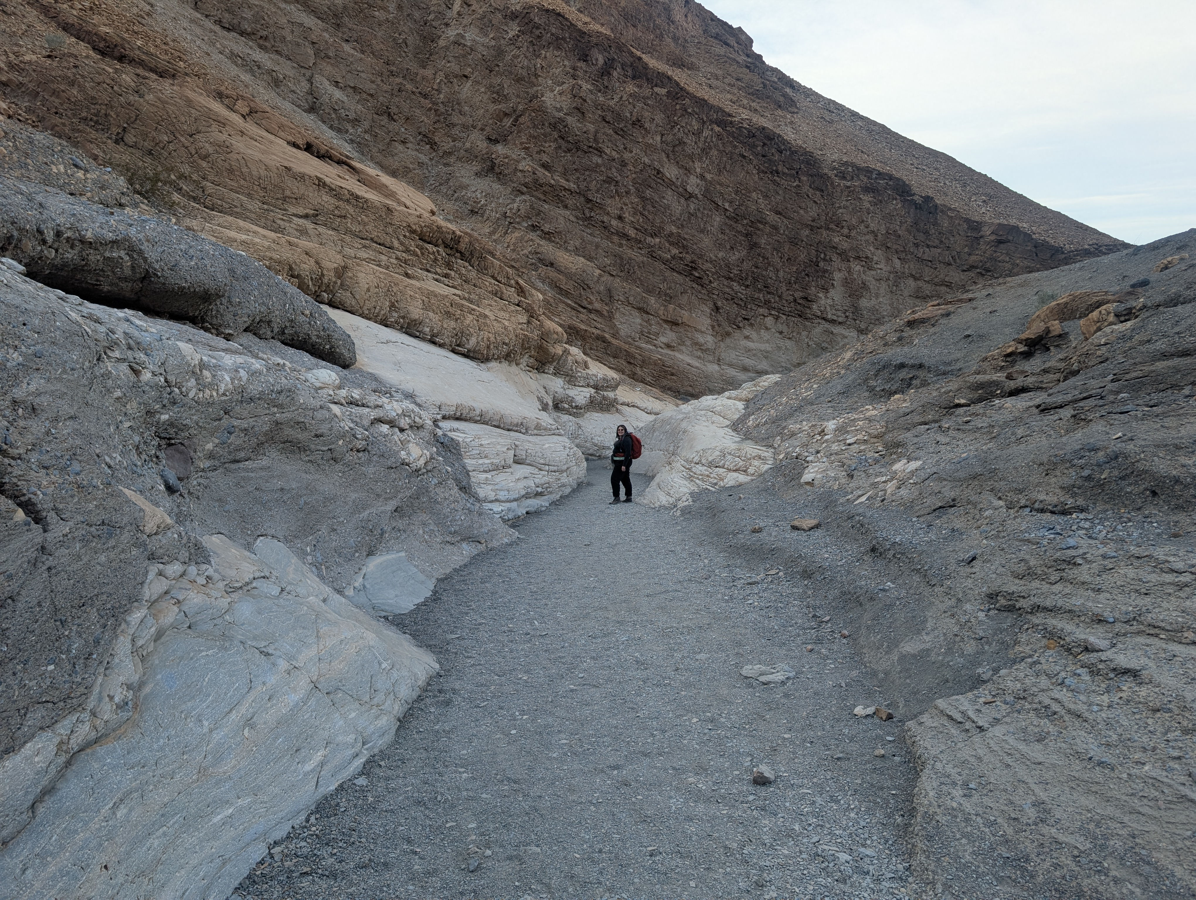
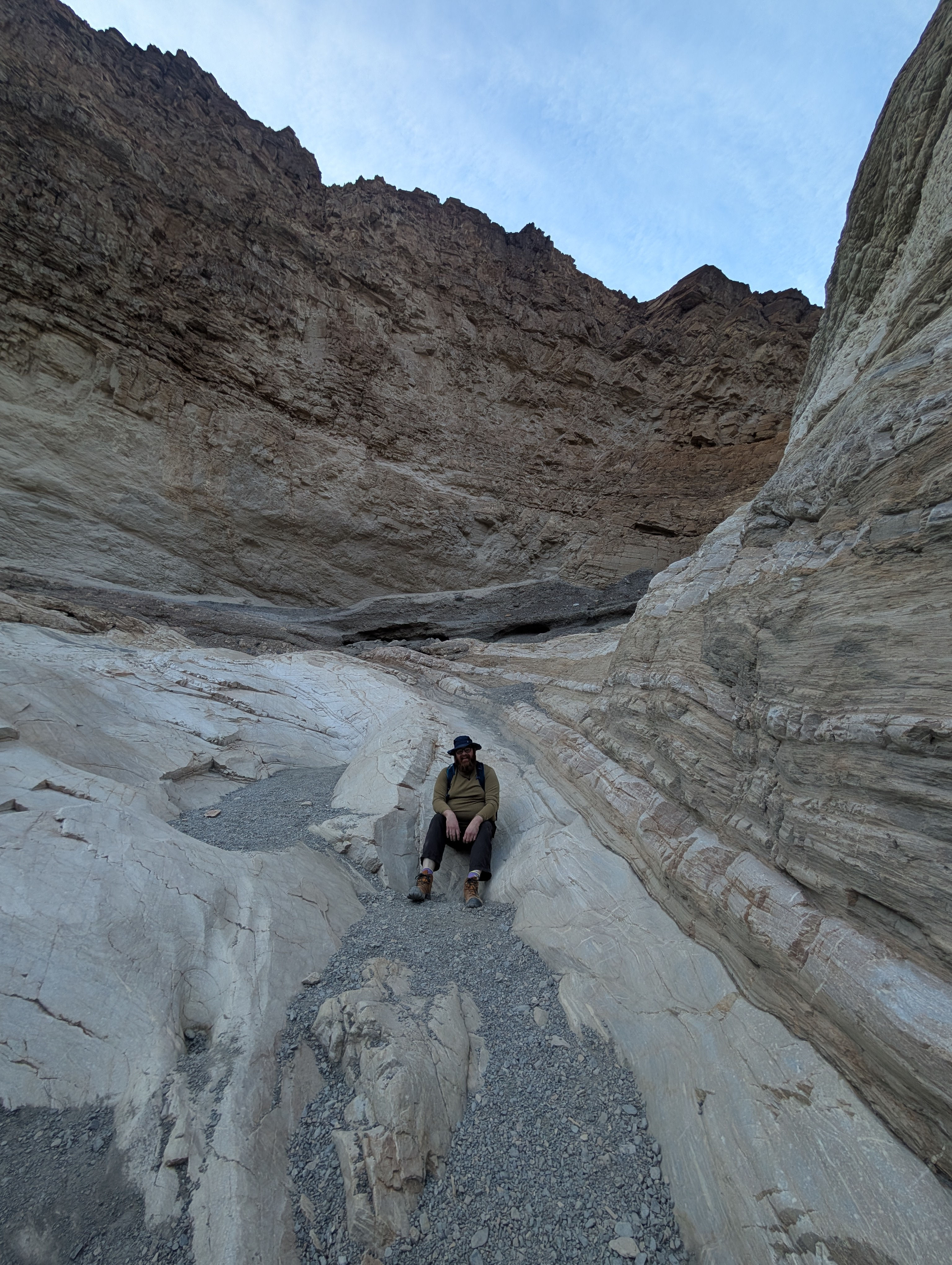
A few hours later we got up and made our way to Mosaic Cavern. This was a recommendation by one of the rangers we had met. The dirt road out to the canyons entrance was rough. our 4x4 got us there but we definitely felt the drive in all our bones. Warning Mosaic Canyon is the site of frequent flash floods (do not enter if there is a chance of rain!), and these narrows have been polished smooth by the scouring of debris-laden flood water. We did not hike the whole canyon due to time but what we got to hike was absolutely amazing and gave us no doubt as to why the canyon was named. It was so beautiful with mosaic breccia [the scientific term for rock created by the natural cementing together of older smaller pieces of rock] and marble and so many many more rock types it was my favorite hike!
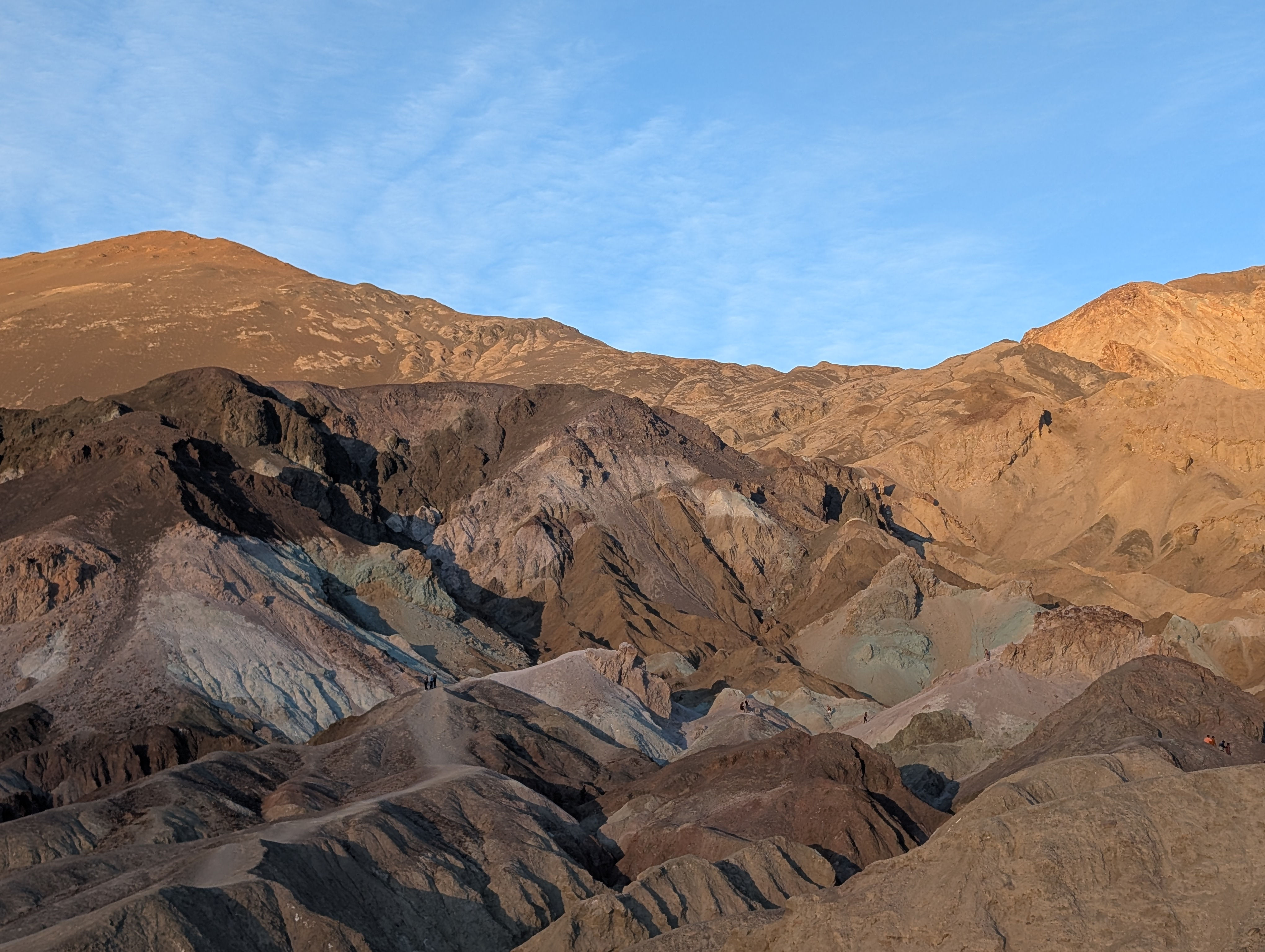
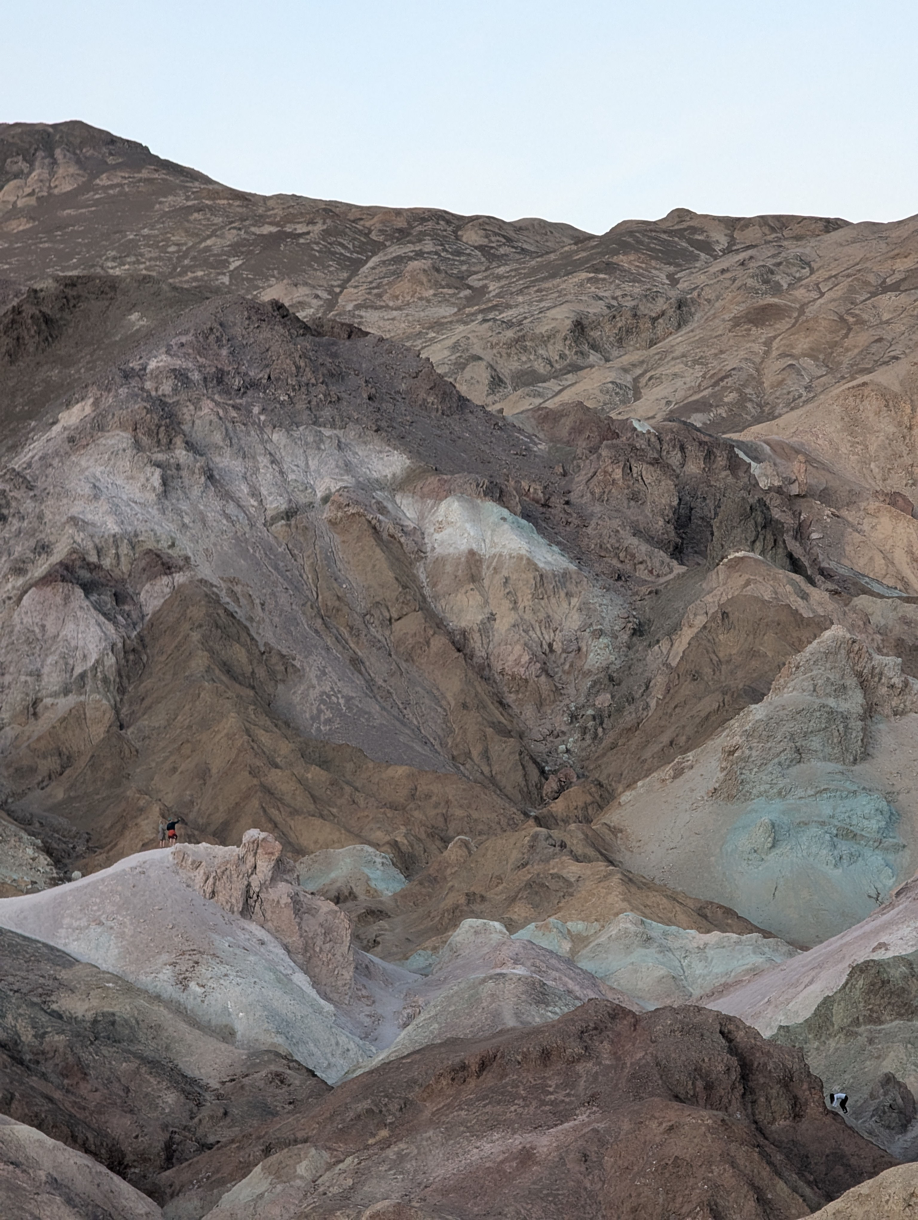
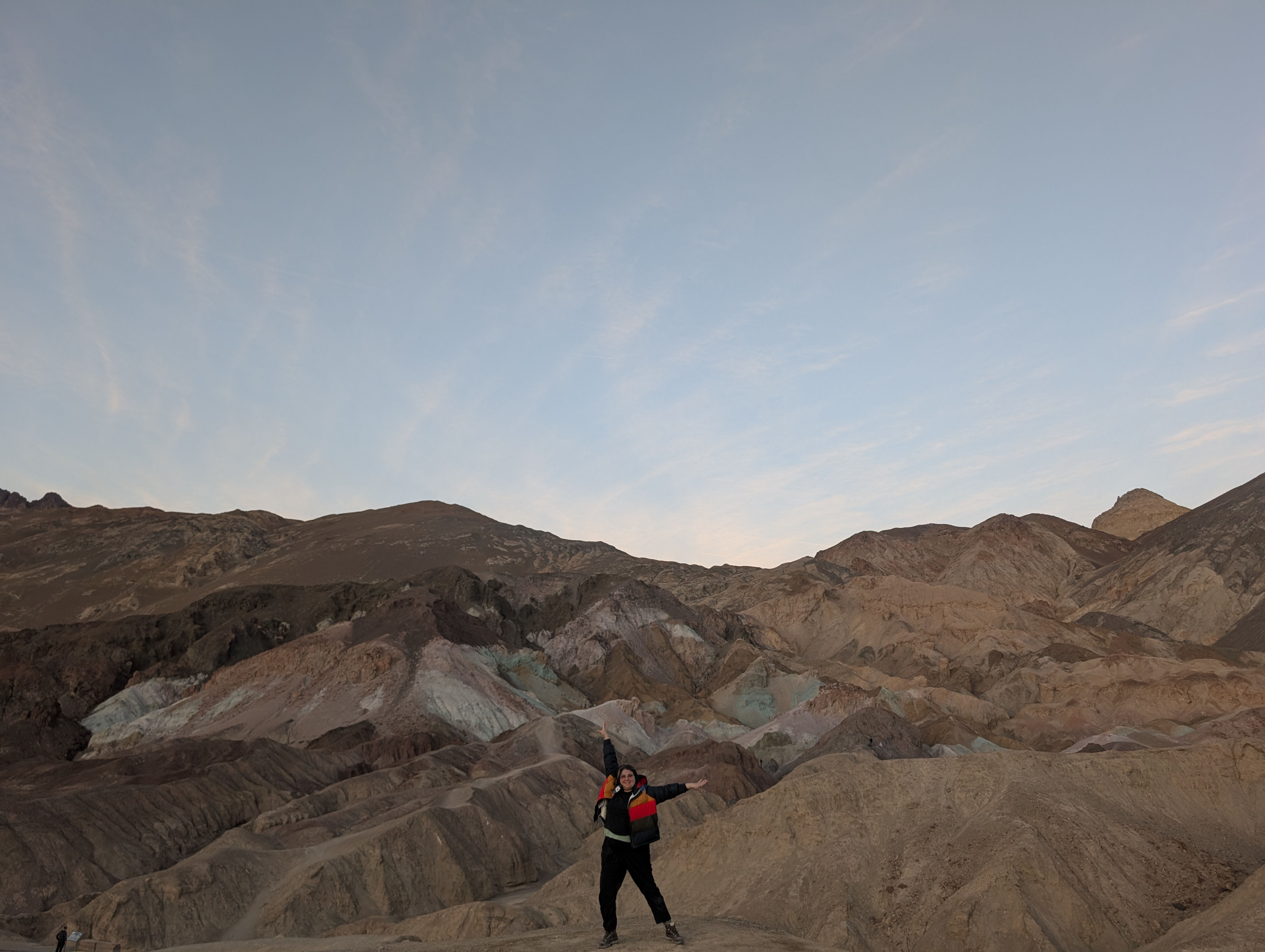
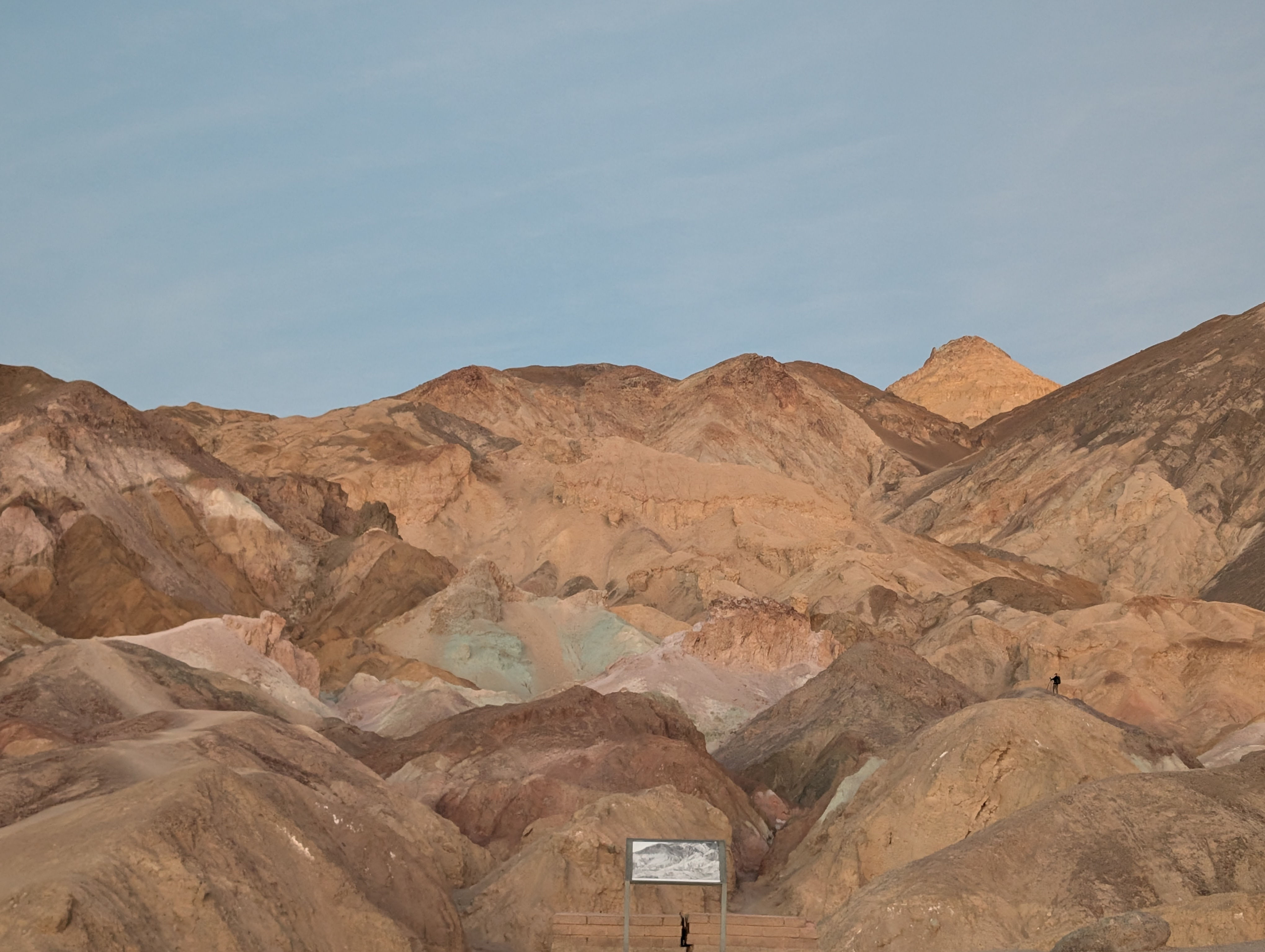
Our last stop of the day was Artist pallet for sun set. A array of yellows, blues, pinks, greens, and reds splashed upon the stone. The park signage let us know that the colors are from volcanic deposits rich in compounds such as iron oxides and chlorite, which creates the rainbow effect according to where the sun lands upon them! We were told that they are best seen in indirect sunlight so that brought us hear an hour or so before sunset and it did not disappoint. The sunset glow was greeted by the waxing moon and it was quite a peaceful place to rest though warning there were a ton of peeps here for there perfect Instagram photo so we ended up viewing the spot from the right of the parking lot where it was much chiller and a great way to end the day before we headed back off to camp
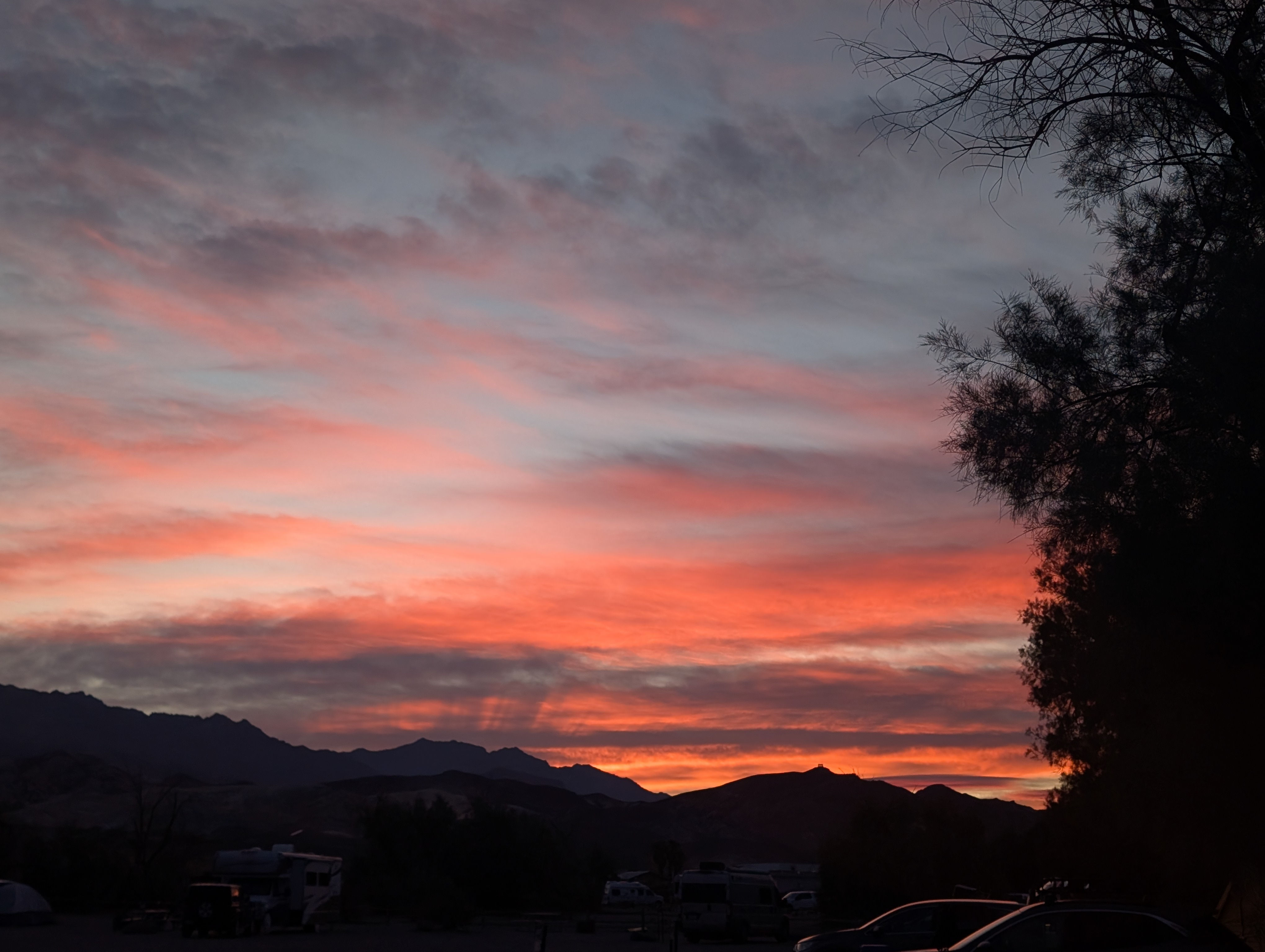
Day 2: The sunrise that greeted us at camp the next morning was spectacular. The previous day had been defined by hues of pinks but orange lit up the sky this morning. It was glorious to watch with my cuppa coffee.
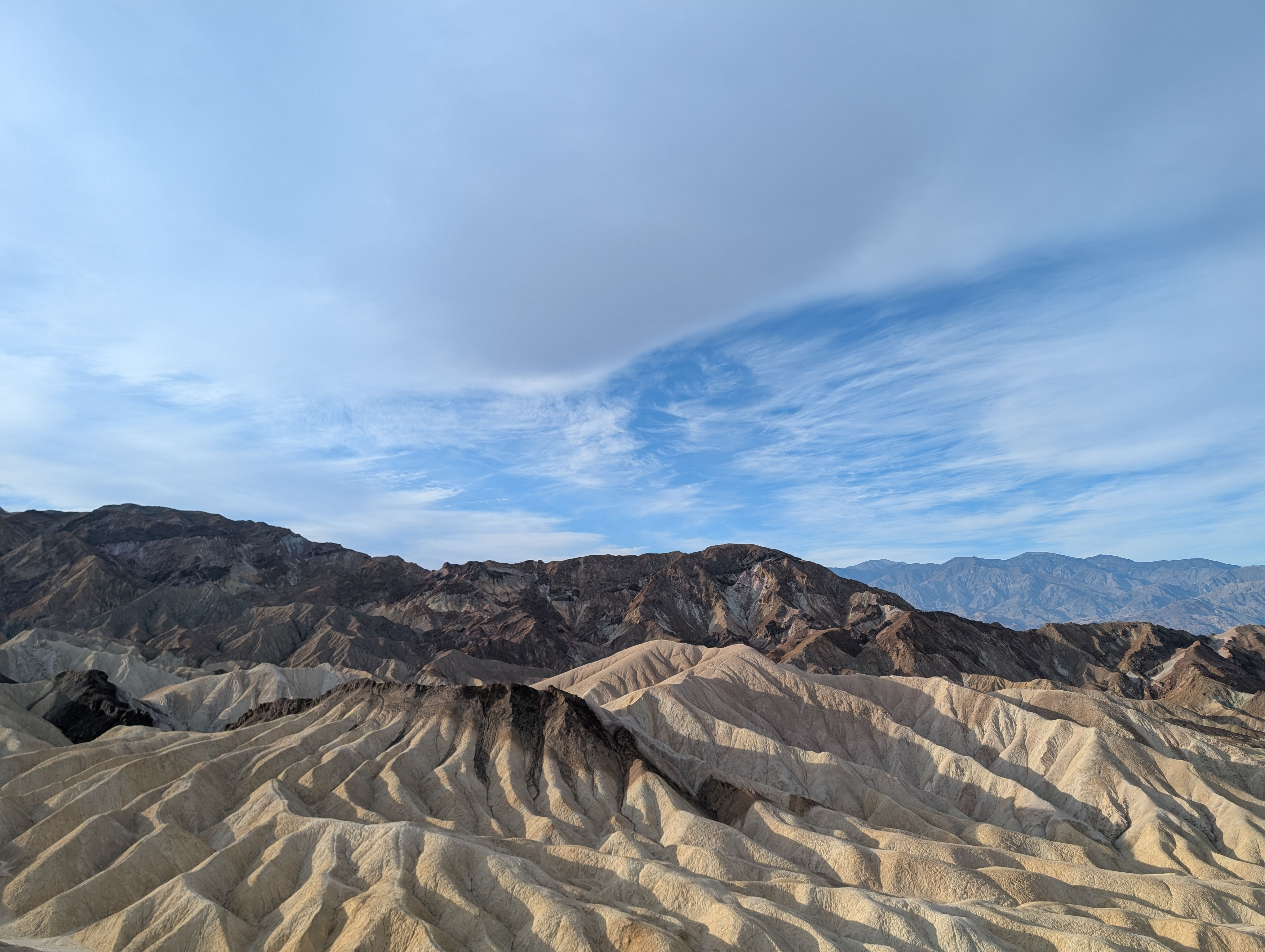
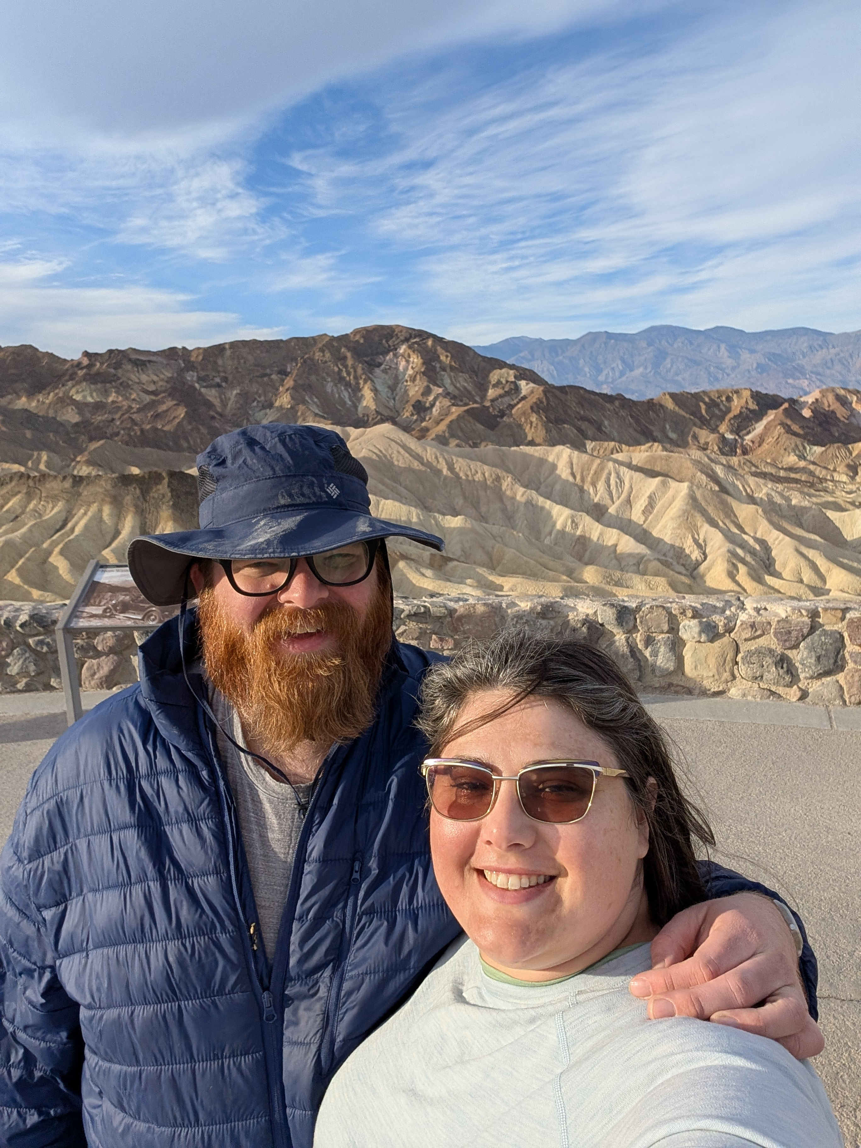
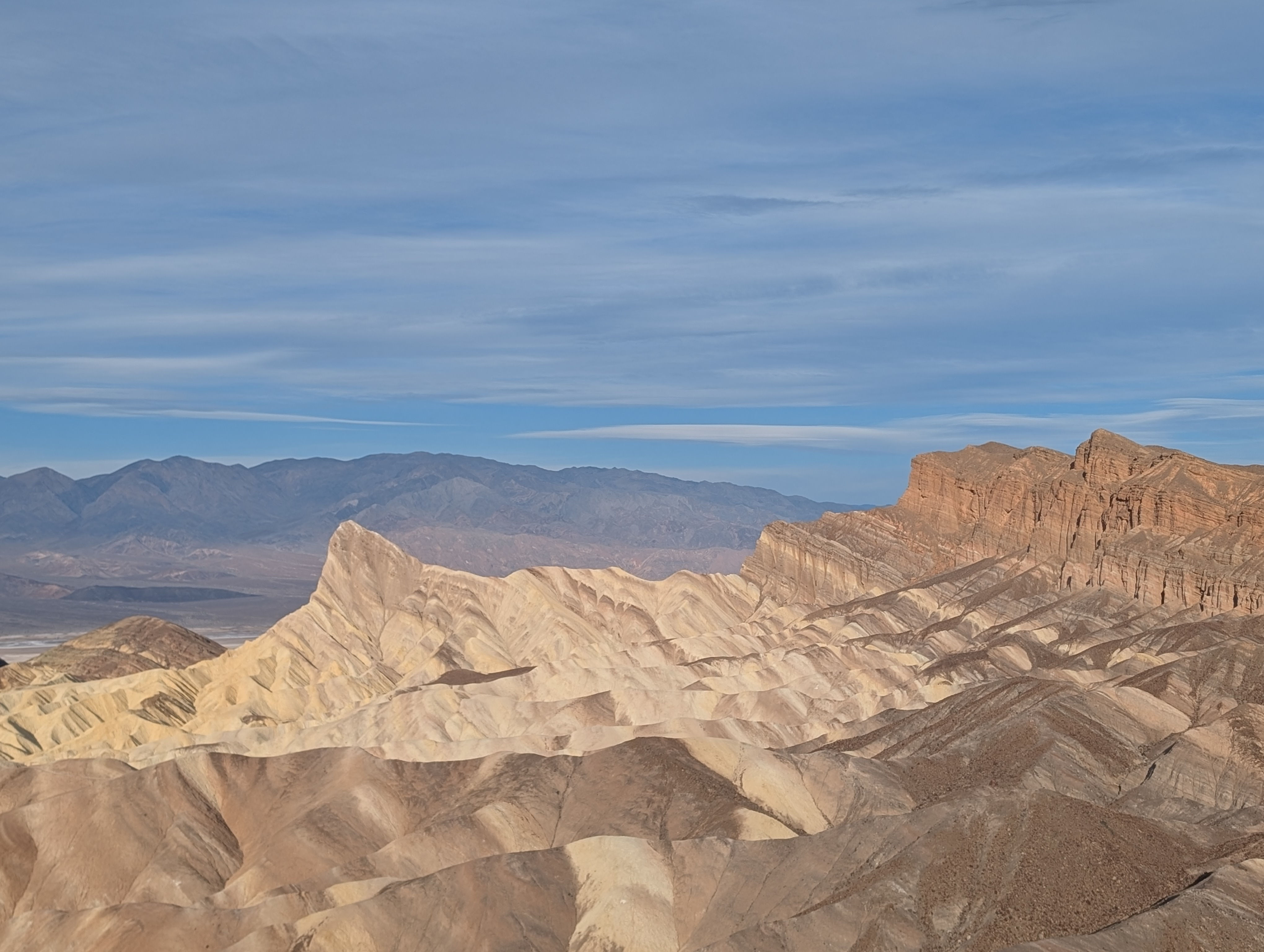
After the tent was packed and we said good by to our camp site; we headed to Zabriskie Point. Now straight from Wikipedia you will find that "Zabriskie Point is a part of the Amargosa Range located east of Death Valley in Death Valley National Park in California, United States, noted for its erosional landscape. It is composed of sediments from Furnace Creek Lake, which dried up 5 million years ago—long before Death Valley came into existence." It was an amazing over look and we were blown away by how other worldly it felt. Now if you were up for a hike this trail would connect with the golden canyon trail from yesterday but as for us we knew we had to book it to make our last death valley stop before heading out to catch our flight!
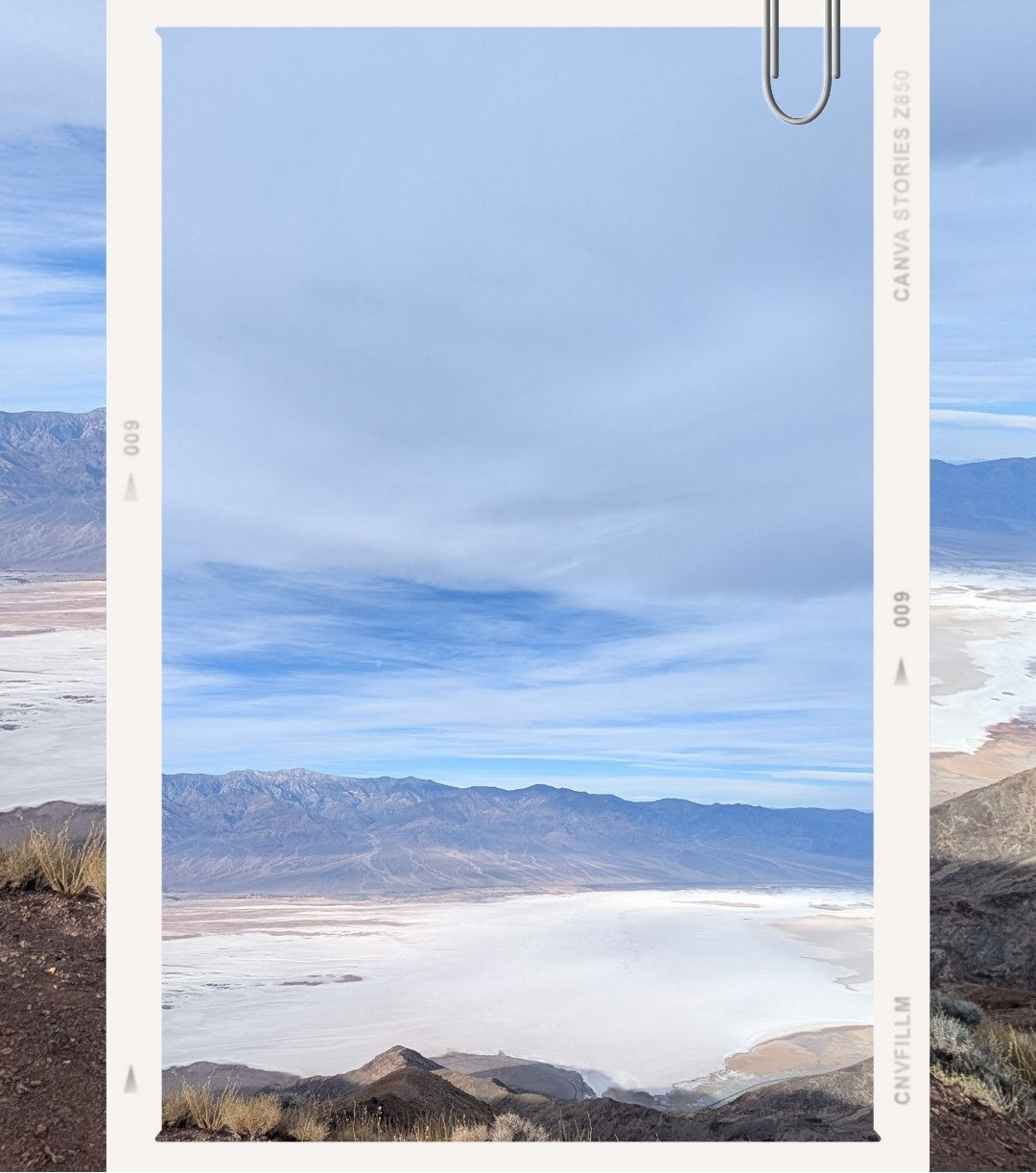
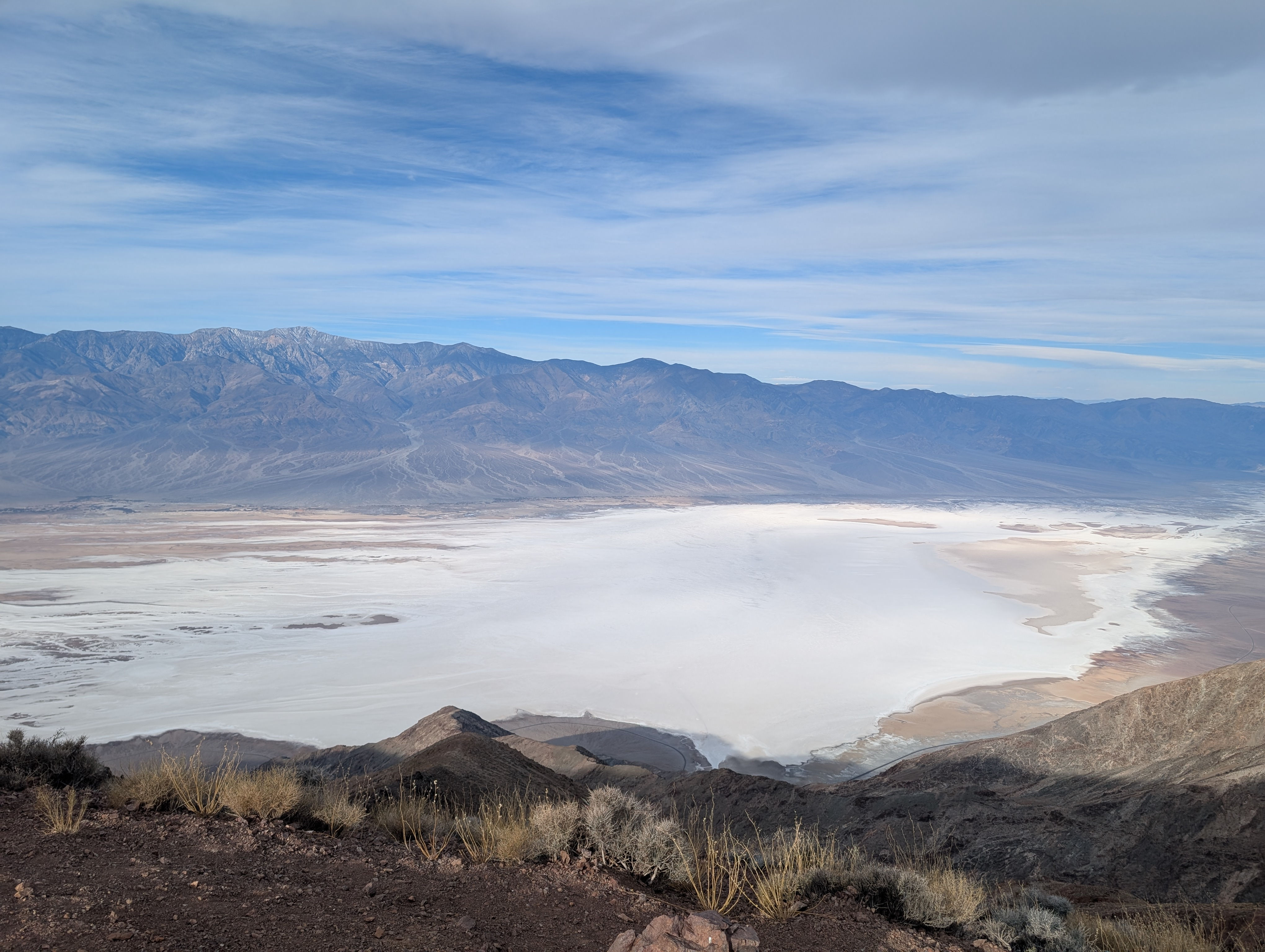
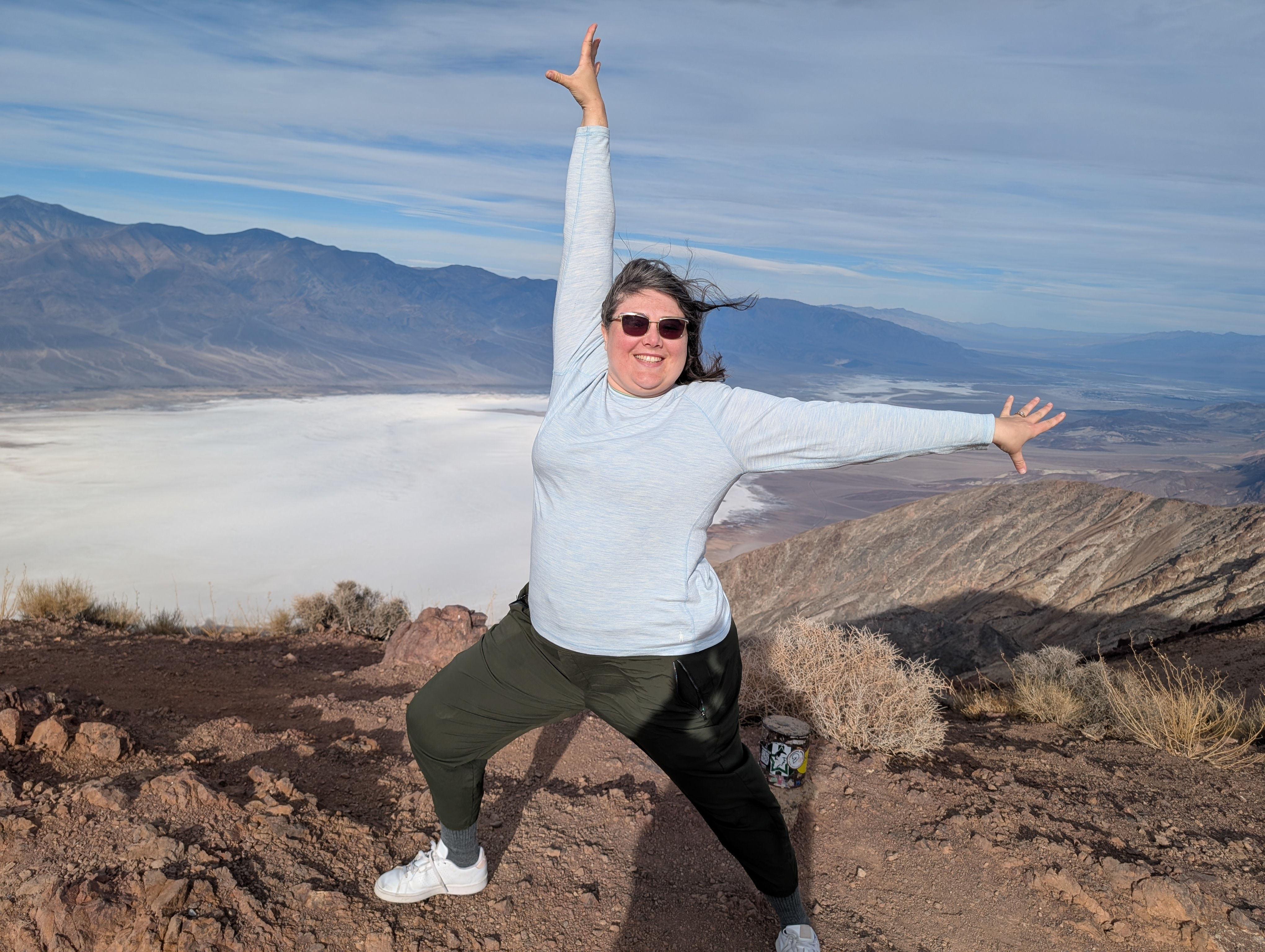
Last stop of Death Valley was Dante's View. Now it was a good drive out and your vehicle needs to be under 25 ft to get there but this view was spectacular! It is directly above the salt flats t hat we got to see the morning before. The story we heart was that Dante's View was named after the 14th-century Italian poet Dante Alighieri, who described the nine circles of Hell, the seven terraces of Purgatory, and the nine spheres of Paradise. The point was definitely a glory to behold and I wish I had gotten to see it at night! the star view from hear no doubt would have been amazing! But we will save that and getting to visit Eurika Dunes for another trip to Death Valley!
On our way out of the park we noted all of the beware of bee's signs and were glad we did not run into any of them at our various stops throughout the weekend.
By 1130 we were back in Las Vegas eating Ramen at Monta Noodles before, returning the rental car and heading home. All in all we were away from Atlanta about 60 Hours for the cost of one vacation day we felt we got to see most of the park!
Death Valley was first protected as a national monument in 1933. On October 31, 1994, President Bill Clinton signed the California Desert Protection Act, which created Death Valley National Park, designated over 90% of the park as wilderness, and added 1.3 million acres to the park. Death Valley is a large place - about the size of Connecticut or half the size of Belgium. Covering 3.4 million acres. It's the largest national park in the contiguous United States.
Thoughts? Reach out at: mythoughtsofindigo@gmail.com